Trees down as major street work for Woolwich to Charlton cycle lane starts this week
A major street project set to last until spring 2027 will begin in earnest this coming week continuing Cycleway 4 from Charlton to Woolwich.
Construction work will see changes for miles starting at a junction near Charlton station heading east along Woolwich Road and the Woolwich ferry.

Cycleway 4 currently runs from Tower Bridge through Bermondsey and Deptford then hits a gap in central Greenwich where plans have bubbled away for 15 years.
After that gap it then heads through east Greenwich, through the dire area under Angerstein flyover before ending at Charlton.

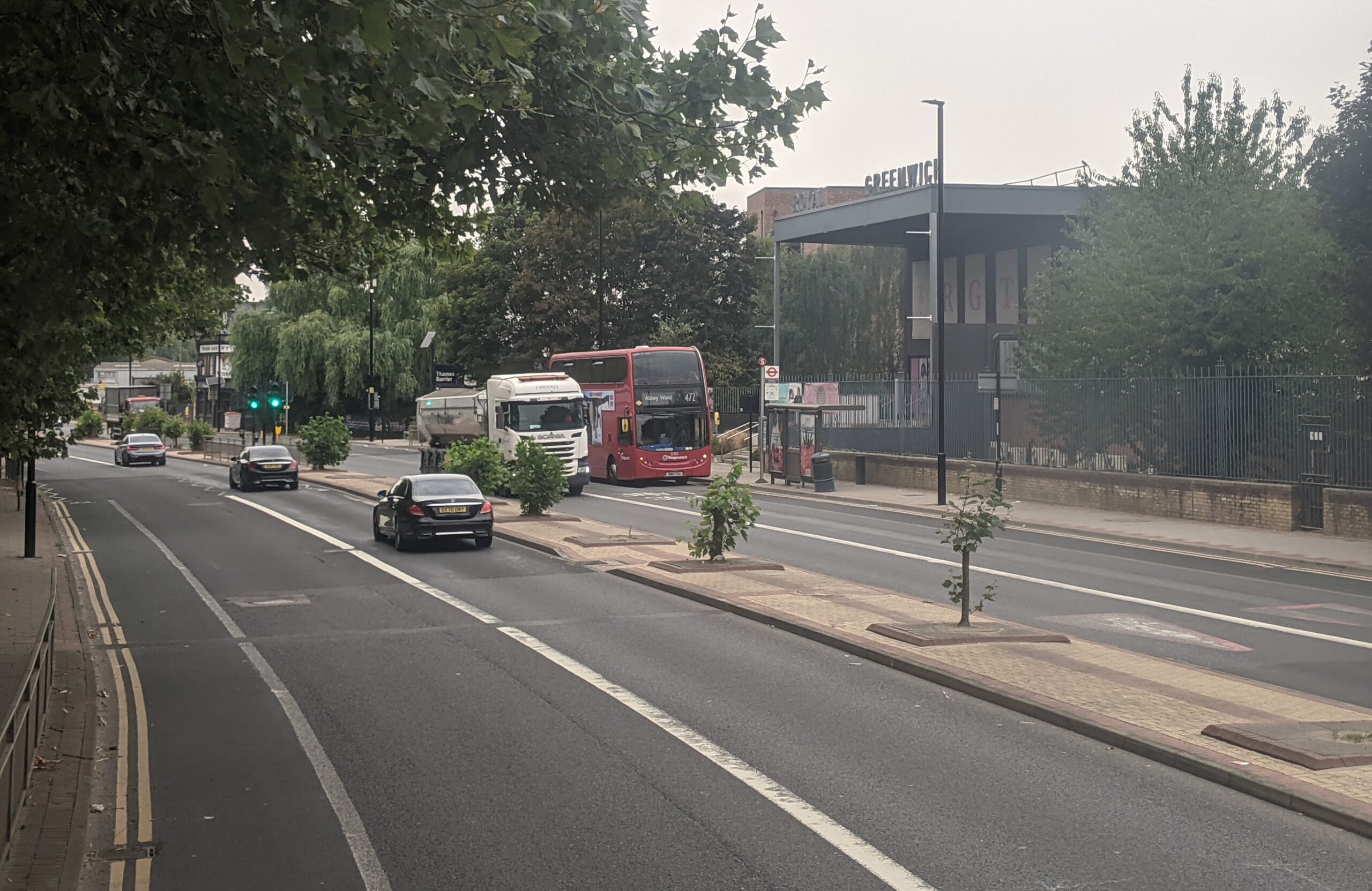
You might have noticed preliminary work in recent months such as the removal of trees along stretches of the central reservation in Charlton.
Not without controversy of course though you have to wonder why Greenwich Council continued to plant trees in this area when the council’s transport department surely knew a major project was on the way. The cycle lane plans have been on the agenda for years.
Some trees date from the last major road change here in the late 1990s in advance of the Millennium Dome though others were being installed recently.
Same again?
Possibly repeating that mistake sees Greenwich now proposing the same elsewhere in Charlton with newly planted trees earmarked for central reservations around Anchor and Hope Lane as part of the Sustainable Streets plan. I’d be amazed if they’re still there in five years given the Charlton Riverside masterplan, a new spine road, a new distribution depot beside Bugsby’s Way and other likely changes.
Can we assume those trees on Sustainable Streets consultation documents are a short term sop that’ll be swept away pretty quickly afterwards? Or maybe whoever drew it up really is unaware of how Charlton will see major change.
Whatever it is, not a good look. Anyway digressing a bit.
Bus lane removal
By far the most contentious part of the cycle lane plan is the removal of bus lanes a short distance from the Woolwich ferry where a steep embankment limits space.
The arrival of Silvertown tunnel has already seen a sharp increase in vehicles heading to the Woolwich ferry which can slow down buses at the adjacent roundabout. Removing a bus lane is unlikely to help.

But then again it may prove a misplaced fear. Hopefully it doesn’t slow down buses including the forthcoming Superloop route SL11 which replaces the 472 between Woolwich and Charlton rather than assists as other Superloop routes do with existing routes.
People along here are already set to see up to eight fewer buses per hour. Slower buses to boot on those that remain will be a bit of a kick in the teeth.
Crossings
Changes aren’t just about cycle lanes but also include crossing alterations including removing the staggered crossing near Greenwich Trust School and Windrush Primary School for one straight across.
Other sites earmarked for a crossing include beside the Mast Quay development, Charlton’s Stone Lake retail park and the eastern arm of the junction where Woolwich Road meets Anchor & Hope Lane.
At Woolwich Ferry roundabout two zebra crossings are to be converted to signalised crossings.
Some turns are also to be banned:
- A restriction on motor traffic is proposed at the level crossing on Charlton Lane which would prohibit southbound traffic across the level crossing. The restriction is proposed in response to data showing a high number of vehicles turning left onto Charlton Lane from the A206, which would present a potential safety issue following the introduction of the cycle lane. The restriction is proposed at the level crossing to maintain access to and from residential properties to the north of the crossing.
- It is proposed to ban the right turns into Kingsman Street from the A206 and from Kingsman Street into the A206, following the introduction of a central reserve. This is to restrict the number of movements into and out of this side road location in response to safety concerns following the introduction of the cycle lane. Banning turns in this location would require a small diversion to the signalised Frances Street junction.
You can view a full list of drawings covering the route here.
Woolwich town centre
TfL also propose a route through Woolwich town centre with a route that seems pretty bonkers.
They expect cyclists to go all the way around the Woolwich ferry roundabout then through busy town centre streets rather than the obvious, faster and more direct route along Woolwich High Street and Beresford Street to reach the areas around the Arsenal and Elizabeth line as well as then the cycle lane to Plumstead.
Presumably the only reason to do this is as its cheaper, and both Greenwich and TfL don’t want to pay for much needed highway improvements along Woolwich High Street and Beresford Street despite thousands of homes and a hotel being built either side.

It’s a familiar tale also seen at Angerstein roundabout under the A102.
On the plus side for the thousands moving into homes all throughout Woolwich and Charlton alongside existing residents and those heading to and from the area there’ll be a clearly defined cycle lane to use.
Currently cyclists have to use the bus lane in places.
But potential upside and downsides apart, you newer know it may all be ripped out again in a few years as ever more homes are built. If sanity prevails a light rail along the line of the old Greenwich Waterfront Transit plans from the 2000s may arise which would link 23k new homes in Greenwich (not far off 20k from Knight Dragon plus thousands more in surrounding sites such as Morden Wharf) with 8k in Charlton (Riverside SPD) then many in Woolwich before heading east to thousands more proposed in Plumstead and Abbey Wood before Thamesmead (15k+), Belvedere (8k in Bexley’s Growth Strategy) and Erith (6k homes).


So iss all abahrt them cyclists on ere then, there the ones who get wot they want. Cut dahn our trees n make us pedestrians unsafe on ere. Thass wot all this is abahrt.
It’s shocking that they are reducing the number of buses on this route so drastically. Seems like a raw deal for the area .
By contrast, City of London have taken the opportunity afforded by the new-build disruption along Moorgate to redo their existing cycling lanes as well as pavements. On the stretch past Cannon Street, there are now areas marked on the newly-extended pavement with ‘Tree coming soon’. Hopefully Greenwich will find some adults who live locally to point out some of the things we need here, beyond pocket parks…
Why can’t cyclists use the bus lane? Then both buses and cyclists will be catered for??
There does seem to be the usual short sighted proposals from Greenwich when the sustainable street ideas are included.
Have you tried to cycle in a bus lane? Cyclists generally travel slower than buses, so buses are held up by cyclists, and that leads to bus drivers getting impatient and dangerously passing cyclists to get ahead. Buses are very large vehicles that can easily kill cyclists. No one wins when buses and cyclists mix.
The only cyclists who happily use bus lanes are very confident and very fast cyclists. Basically, middle aged men with expensive bikes, or those with illegal e-bikes that go faster than 15.5mph. If we want to encourage more people to cycle, we can expect cyclists to use bus lanes.
I’m not exactly happy about bus lanes being removed though, given that bus speeds and reliability are down all across the capital. The main question is why buses and cyclists have to fight for space when there are other traffic lanes that could be repurposed…
Because busses are horrible to be around as a cyclist. I’ve had several very dangerous overtakes by busses while cycling in Greenwich and Woolwich including along this stretch.
The sustainable streets proposals are so depressingly unambitious, should go much further in discouraging polluting car journeys and ownership (incl my own car!) and making cycling and busses viable.
How many people do you see cycling in the middle of winter?
These plans aren’t perfect, the strange diversion in Woolwich town centre, the omissions of some accesses in some places, the removal of the bus lane in some sections, but overall it’s a positive step forward. Hopefully these plans spur the council on to pull their finger out and develop and deliver a new cycling and walking plan, but I won’t be counting on it given their complete lack of action in this area, and in fact a slight regression.
It’s maddening they’re considering going through a busy pedestrian street when the Thames path is literally right there. It wouldn’t cost much to sort out the bike lane from the Ferry roundabout to the back of where the leisure centre currently is.
If a cycle lane is rubbish then people don’t use it, they’ll either go on the roads or not bother cycling at all.
To be honest, cycle lanes are a bit boring to ride along though. Maybe a few low jumps here and there, or a ‘loop de loop’ section would get more people interested and excited to get on a bike.
People do complain about island bus stops. Ramps over them could liven things up.