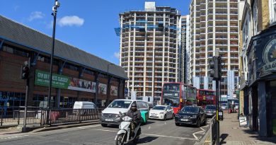
Woolwich Crossrail housing plan: Plans in for 523 new homes
An application has been submitted to build towers above the eastern end of Woolwich Elizabeth Line station.
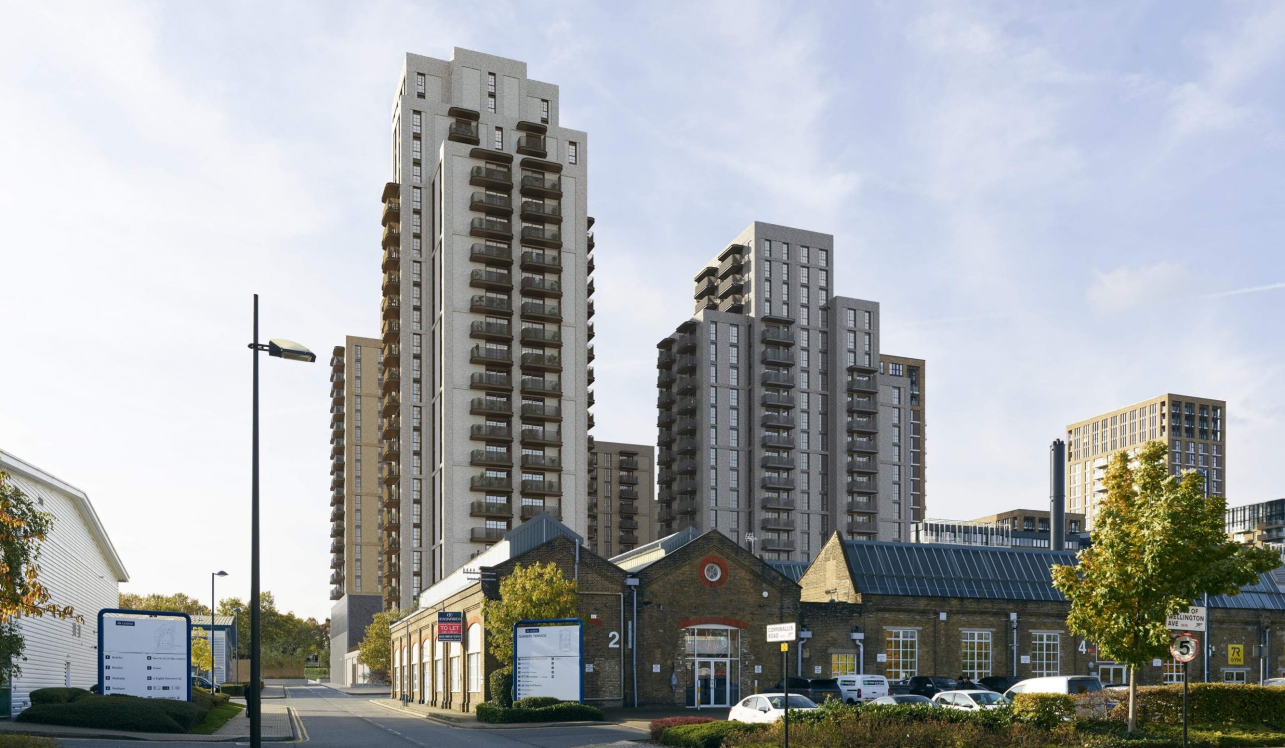
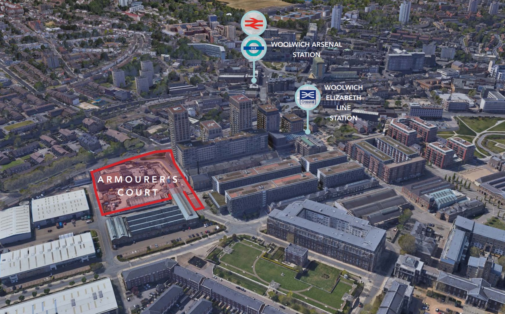
Six buildings will sit above the ventilation and emergency exit area of Woolwich’s Elizabeth Line station and join a range of major developments in the immediate vicinity.
The project is a joint venture between TfL and Berkeley Homes – and follows scrapped plans drawn up seven years ago.
It’s a shame no attempt was made to ever include a second station entrance for thousands moving into new homes in the area as well as existing Plumstead residents.
After all, plans for 2,200 homes in Thamesmead across three sites in recent years have all but ignored easy access to Plumstead station, so a second entrance at Woolwich would have helped. No dice.
The application itself is a real dogs dinner with the Design and Access Statement alone split into numerous sections. Opening part 13 and wanting to check something back in part 4 (or was it 5?) is great fun.
Hundreds of documents are listed.
It’s almost as if it’s made as tough as possible for people like yours truly to go through, but go through it I have.
Affordable homes
Previous plans drawn up in 2014 saw 394 homes. This is now increased to 523 homes, with “affordable” up from 15 to 35 per cent.

That of course, only tells us half the story.
As is common, 35 per cent of the total won’t really be “affordable”, as of that total 70% (128) will be “social/affordable” rent with at “least 30%” London Affordable Rent – which is the closest to social housing. That means 70 per cent could be the more expensive London Living Rent.
To reduce totals yet further, 30% (55) of the total 35 per cent labelled “affordable” will be shared ownership and we know given costs of a mortgage, rent and then service charges (plus being on the hook for other costs) makes this tenure anything but affordable for many. It simply shouldn’t be included in the “affordable” bracket.
We could end up with just 32 social homes out of 523. Not great when the borough’s homeless household numbers are skyrocketing and more than doubled from 750 to over 1,500 since 2018.
Transport
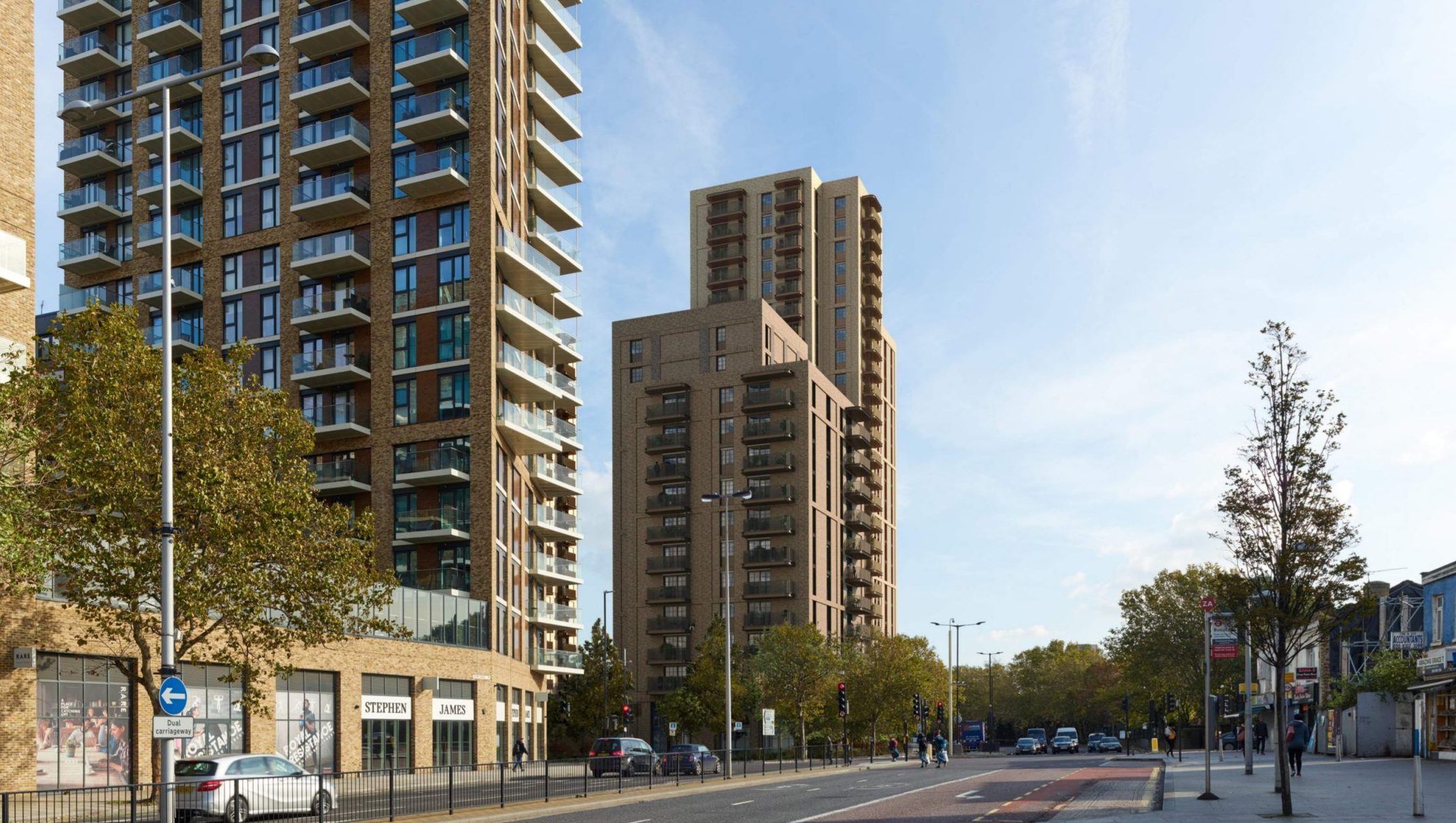
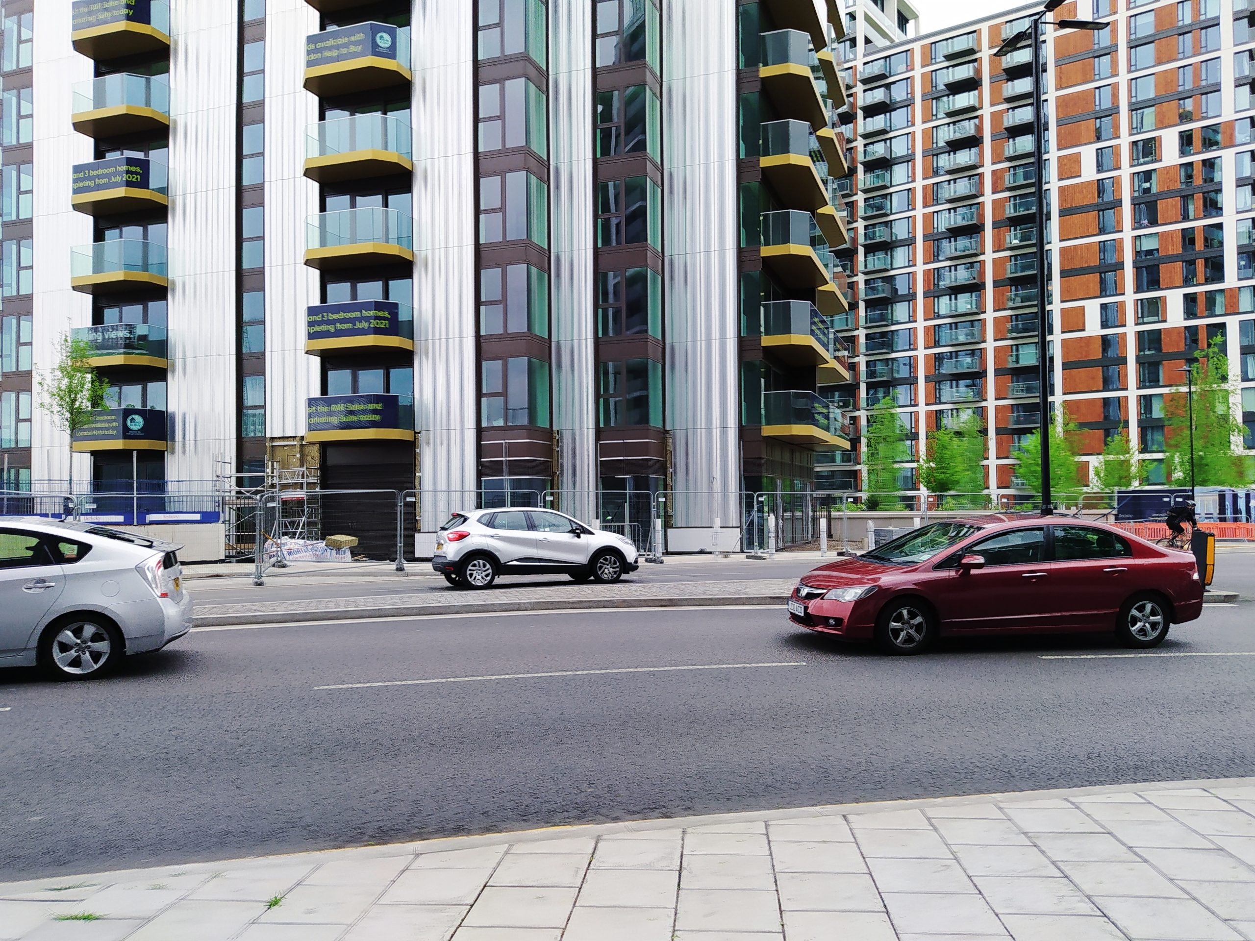
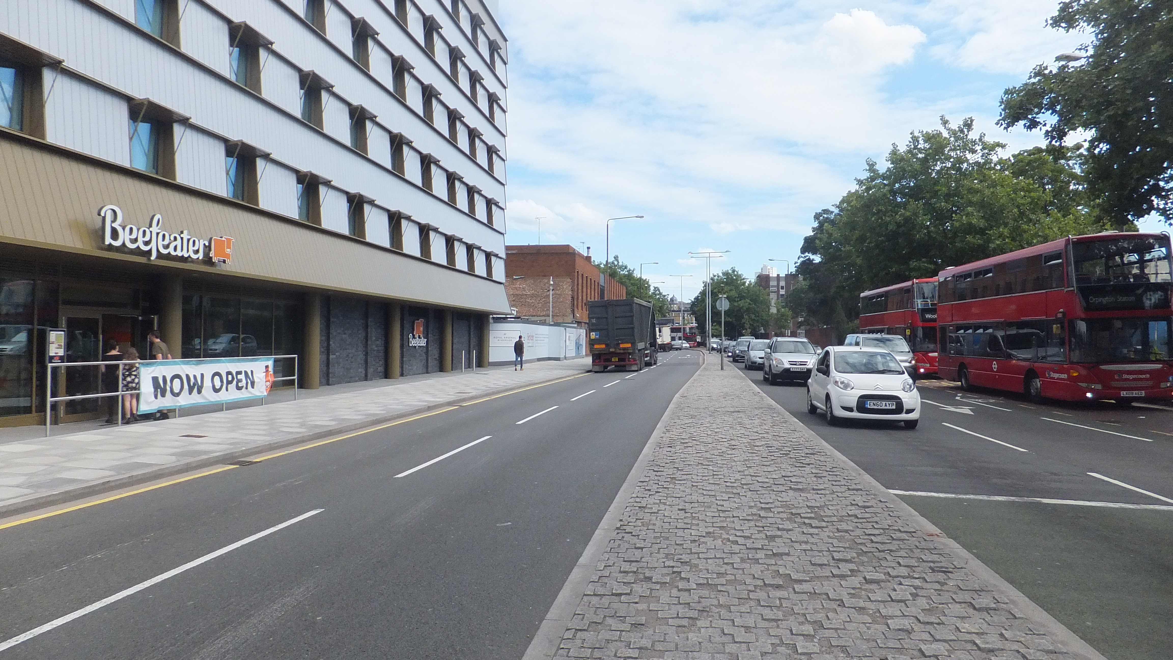
It’s car-free as expected at a site on top of a major new railway station.
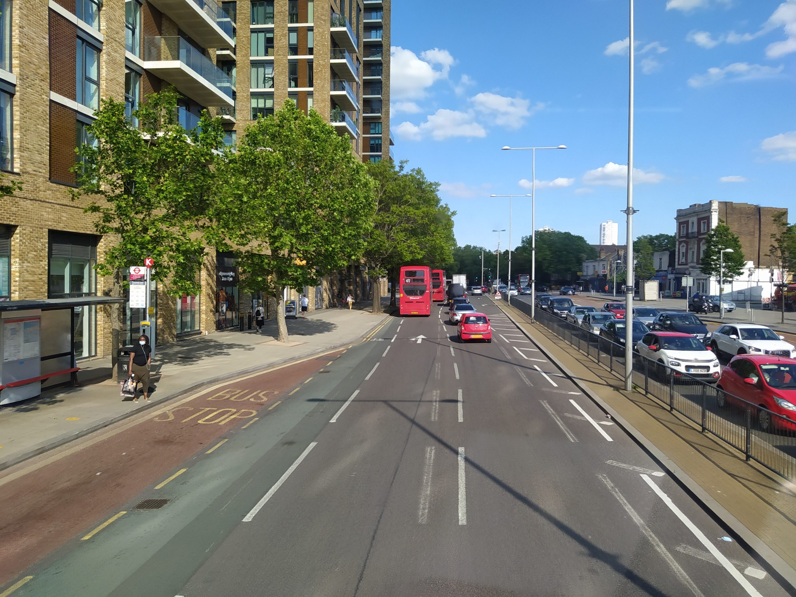
It does have over 900 cycle spaces but the road outside has no dedicated cycle lane despite millions being spent on public realm (which ended up with the road looking like a major rural A-road) and numerous developments in the area, including Spray Street Quarter / Woolwich Exchange over the road.
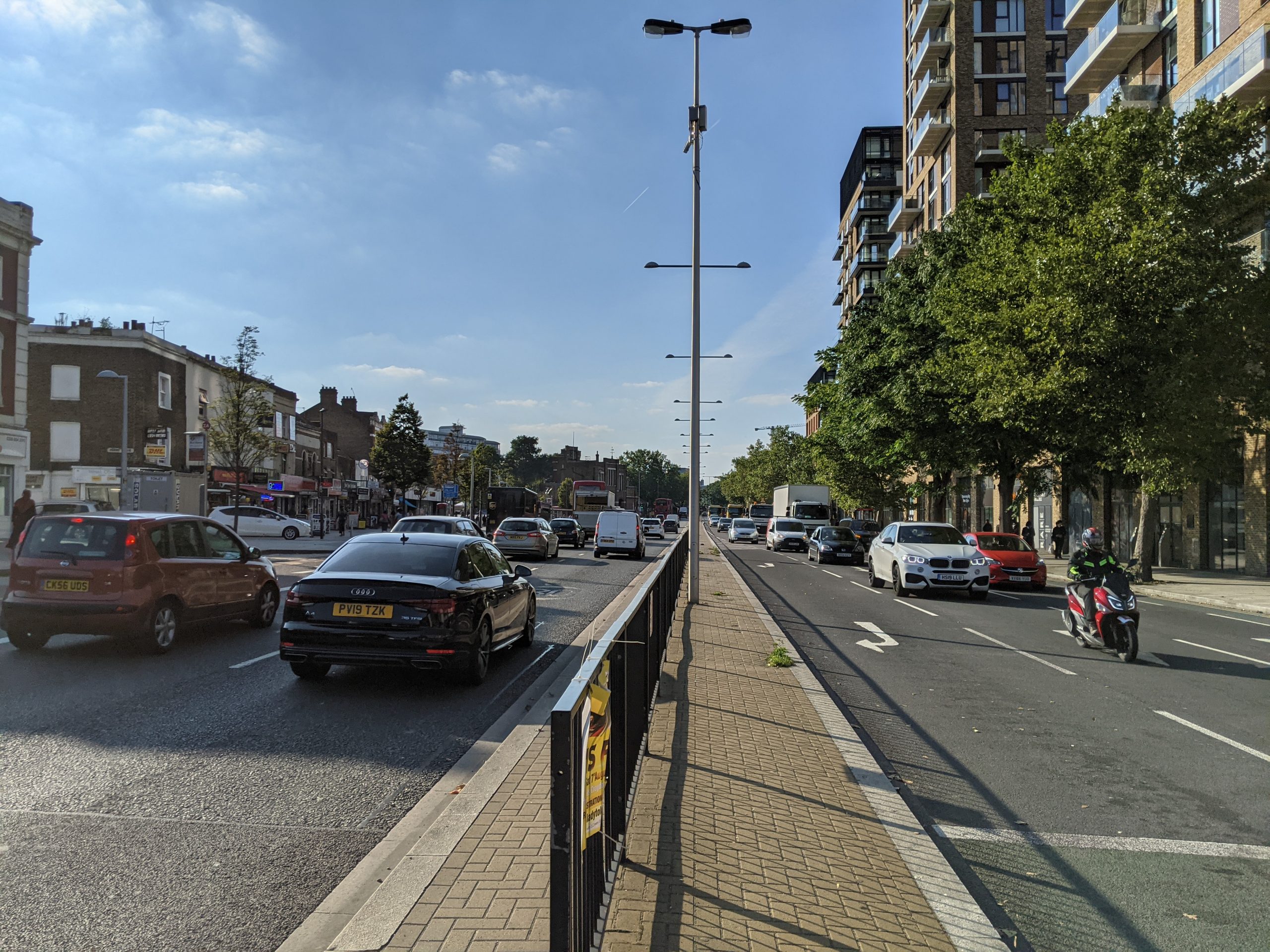
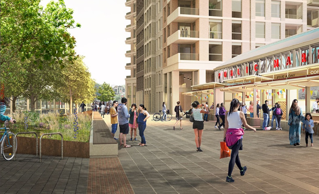
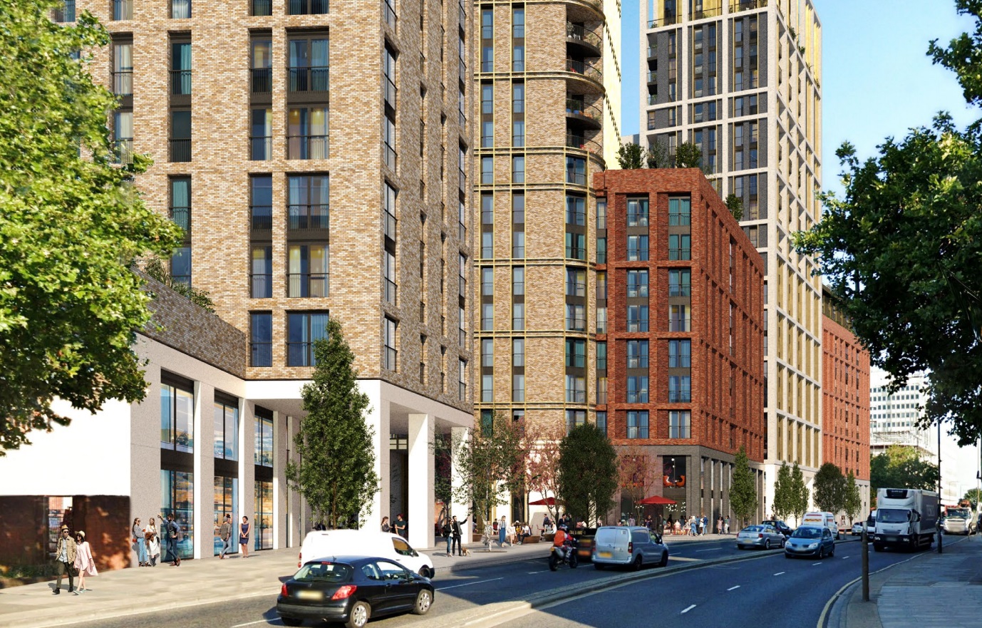
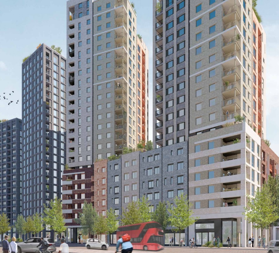
Renders of the project show narrow paving outside the new development facing Plumstead Road and no segregated cycle lanes.
And so the renders show people having to walk their bikes.
Could narrow paving and a lack of a cycle lane be as the station box is located too close to the road? Nope.
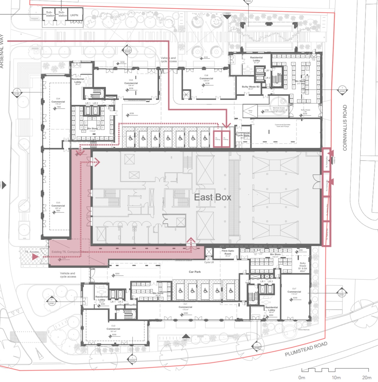
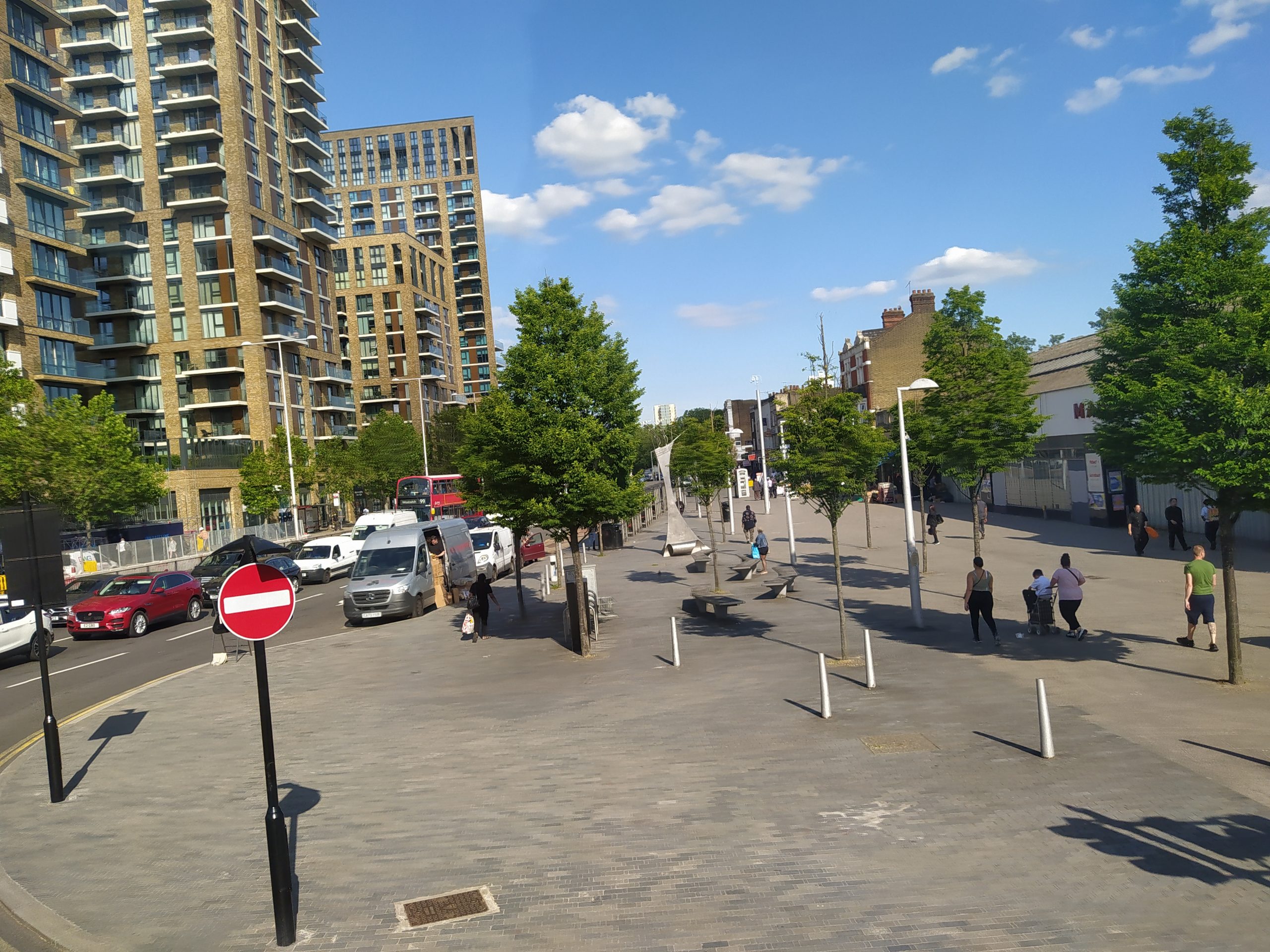
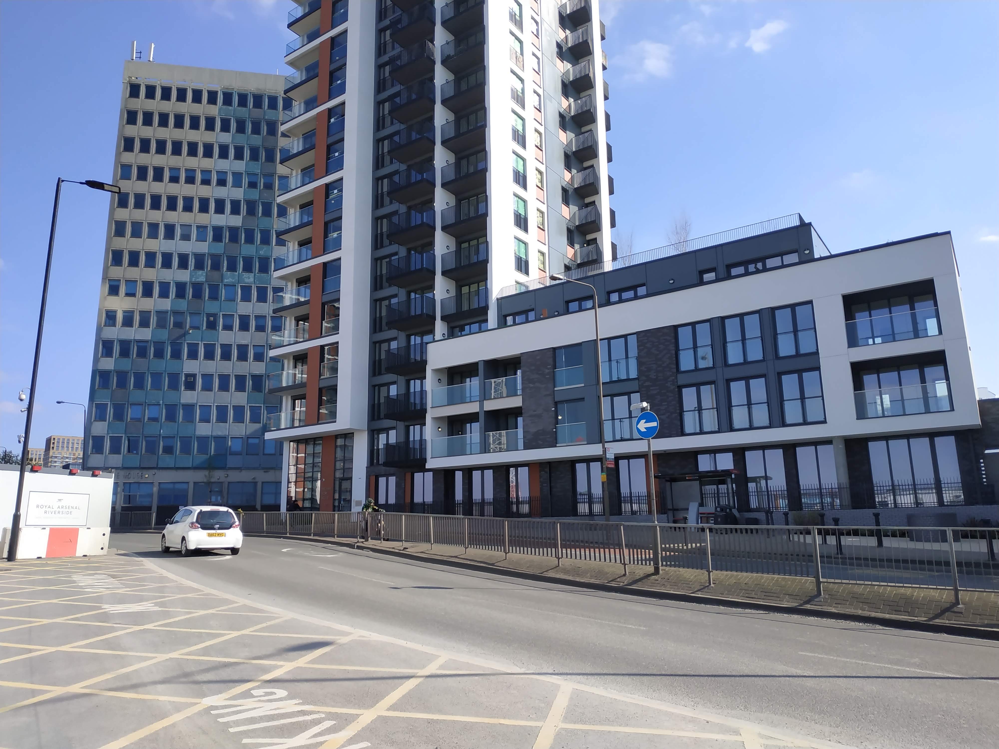
Here’s the station box as it currently looks. There’s enough space:
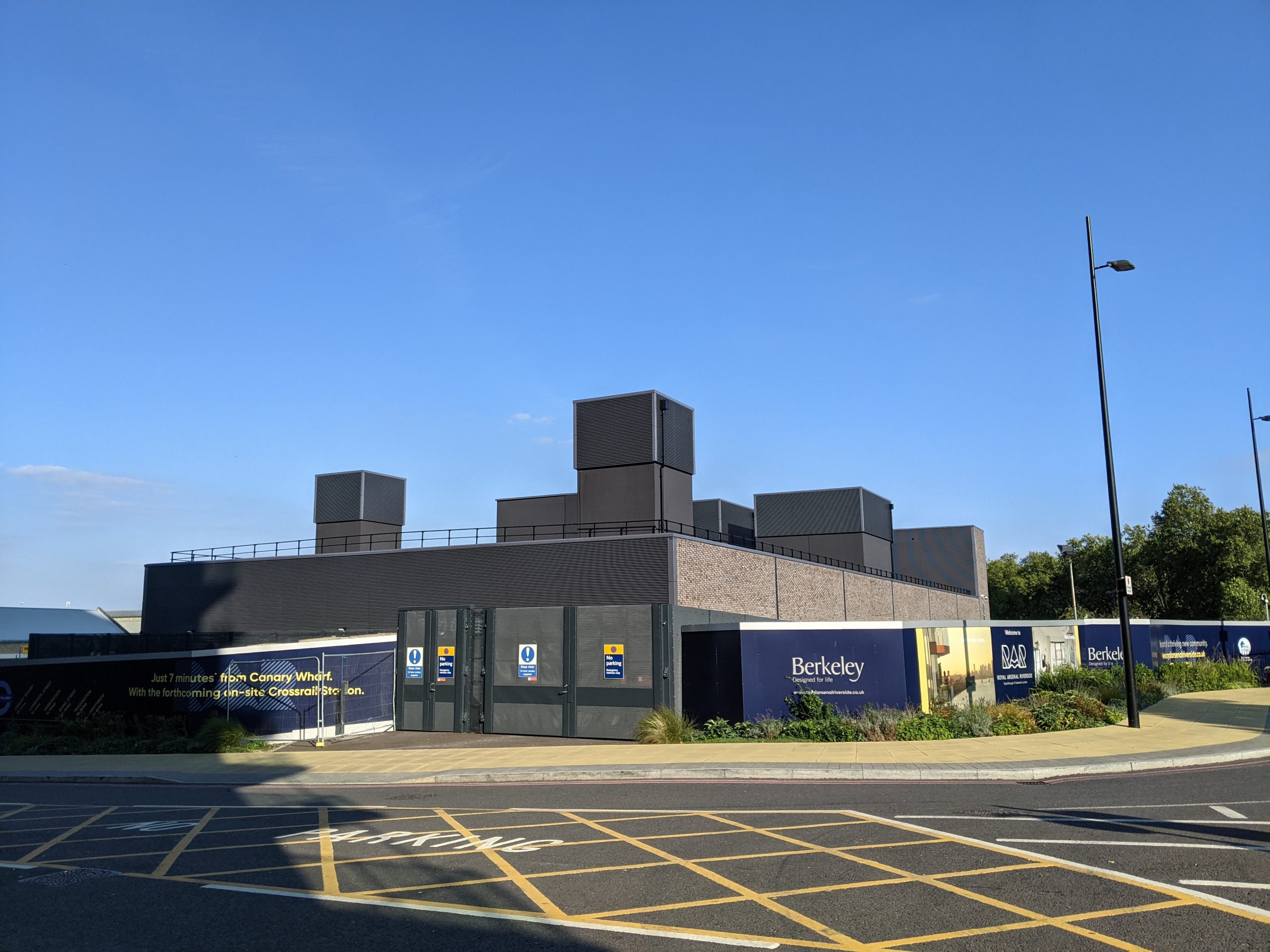
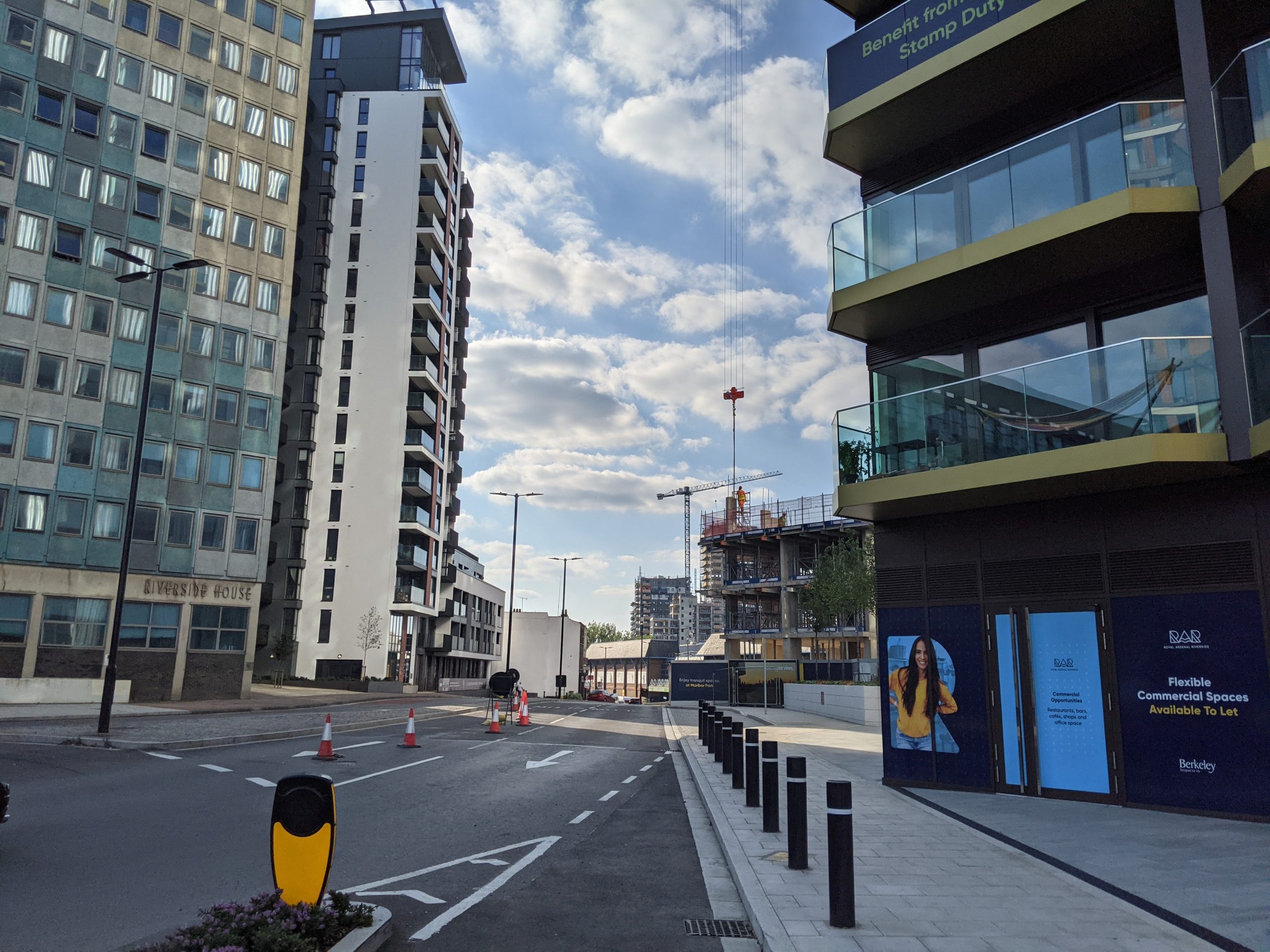
Let’s have a look at another image of the wider area. If a dedicated cycle lane cannot be installed here where ample space exists and plenty of incoming funding to provide it, then where can it?
What was that again in endless Greenwich Council reports about encouraging active travel? This first major submission after they adopted the Carbon Reduction report of 2021 continues what’s occurred over previous years.

This is also a TfL joint venture. Why are they not insistent?
Greenwich planners and TfL should have been banging the drum for this is pre-submission meetings. Though given Greenwich planners last month ignored improved active travel, TfL guidance and their own council policies and reports with 330 homes in Thamesmead it’s little surprise they’ve failed again.
A few very small areas of landscaping achieves a lot less for the environment than a cohesive cycle lane network that could reduce many vehicle journeys.
Vast number of plots
Imagine having a major thoroughfare through all these developments shown below and achieving nothing to improve active travel:
Here’s a brief list of recent developments that could have funded such a lane to create a cohesive, sustainable network:
- Armourer’s Court covered today
- Woolwich Exchange/Spray Street directly opposite
Spray Street plans see no cycle lane along main road, and raised planters reduce space for a cycle lane:
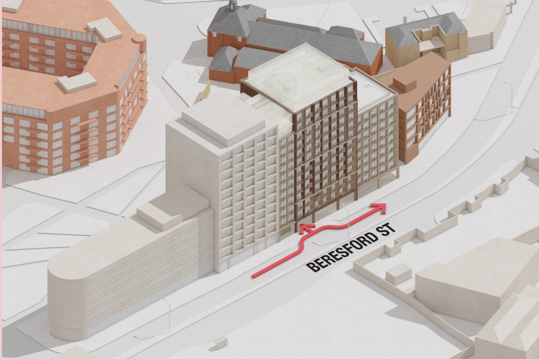
- Berkeley Homes’ blocks above Crossrail station
- MacBean Street. Not yet approved but submitted plan all but ignored cyclists:
- Callis Yard tower:
This saw no space and no income derived from this site has been spent by Greenwich on installing a lane. Car regularly park reducing useable road space as does a bus stand.
- Berkeley Homes’ towers on former Waterfront car park:
- Premier Inn hotel:
More wide central reservations. Again no safe cycle lane.
There’s also the recently submitted plan for 300 student rooms in a new block at the Catholic Club site:
Yep, it looks like nothing from that either.
How many developments in very close proximity can there be before Greenwich follow one of their numerous reports? All these sites have brought substantial funds to the authority, they’ve all been through discussions with Greenwich Council’s planning department pre-submission and nothing has happened.
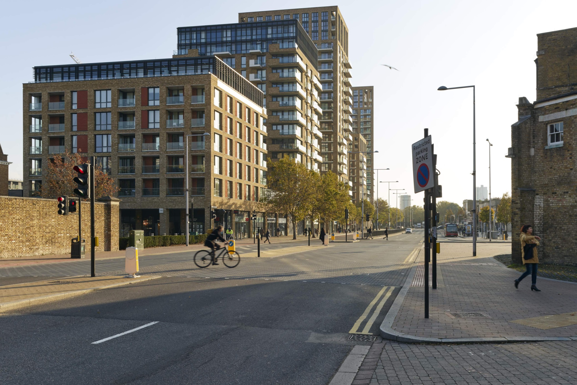
The crazy thing is a segregated lane is located just east of Woolwich from Plumstead but it simply stops at a junction opposite the new proposal.
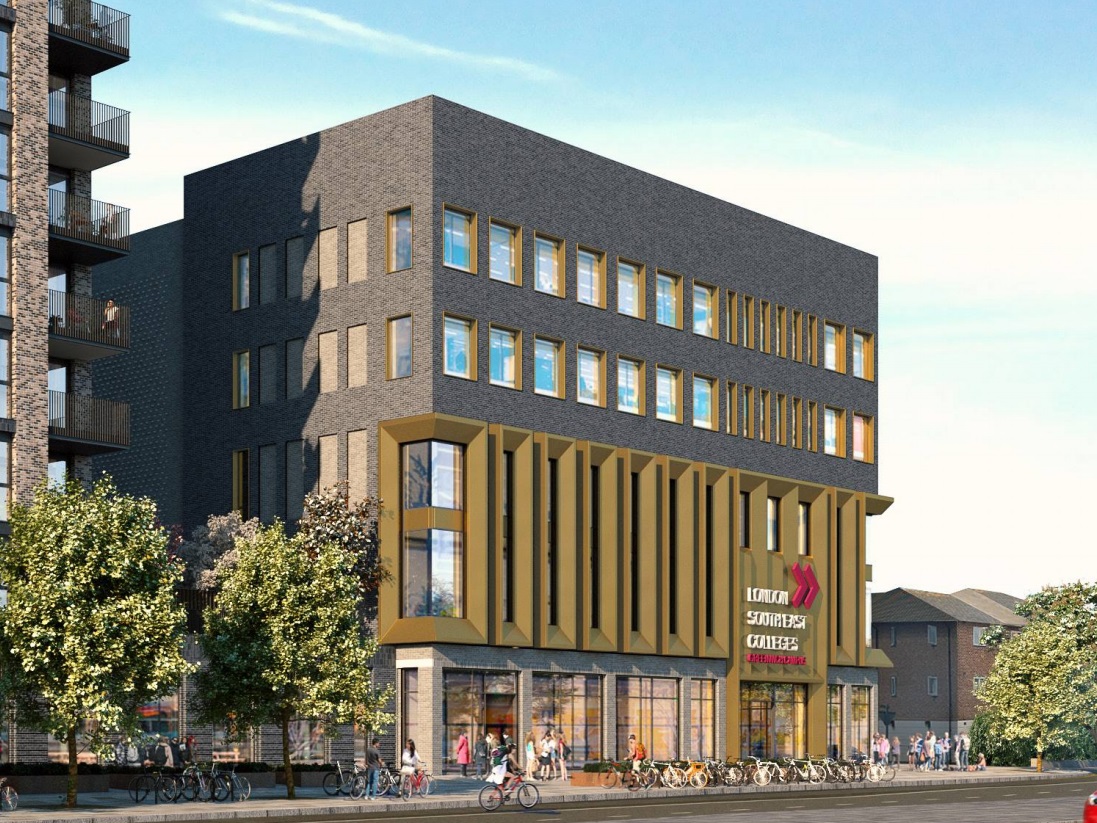
The above image is viewed from a point next to Woolwich College – another site being rebuilt with hundreds of homes and bringing income for transport improvements in the wider area.
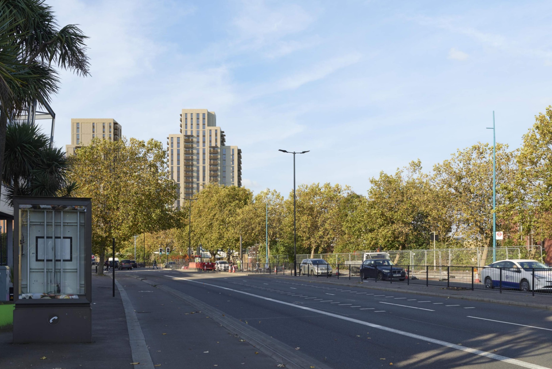
There’s another dedicated cycle lane proposed a mile west at Cycle Highway 4 – but despite numerous major developments it’s not being filled in the middle. Meandering diversions along the river are instead expected.
Numerous renders of the latest plan at Armourer’s Court again show cyclists either having to walk or use the busy road:

People want to get from A to B efficiently and quickly when on foot and cycle. Barriers, lack of direct cycle lanes and poor quality paving simply encourage driving.
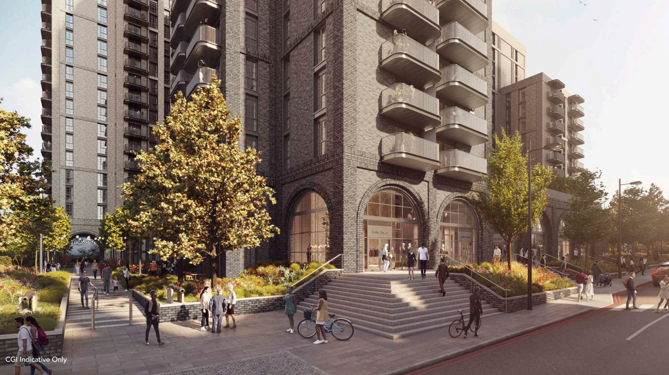
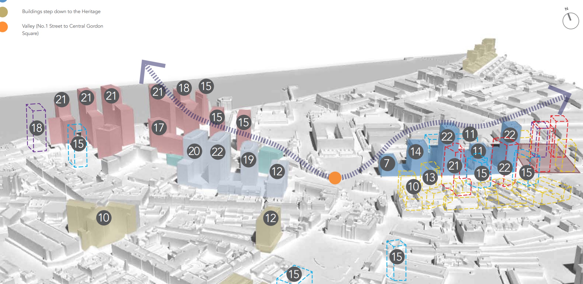
Massing
Another odd thing about Greenwich Council Planning Department’s strategy in this area is that they’re apparently content for numerous towers to exist all around the same height, and then a sudden drop to just two storeys a short distance from a major new public transport station.
What would make far more sense is for building heights to taper down from these towers towards the east while designating the wider area for residential and mixed use.
Much of the “industrial” space directly next door are business that could easily be located in mixed-use schemes – such as soft play – while those that could not be accommodated can move to unused land just to the east in Thamesmead.
There are still unused industrial sheds and empty plots of land at the White Hart Triangle site a mile east 20 years after it was built at high cost.
What is imminently sensible is to designate and then locate much-needed housing near major transport nodes, and industrial units in an area suitable for industry. This doesn’t seem rocket science but not what Greenwich planners seek to do in their site allocations strategy, and doing so again undermines attempts to get people out of cars.
Jo Cowen Architects are behind the design for Armourer’s Court. Their knowledge of the area is so great they state it’s in east London.
Running a site alone takes time and a fair bit of money. Adverts are far from enough to cover it and my living costs as a private renter.
You can support me including via Paypal here Another option is via Patreon by clicking here You can also buy me a beer/coffee at Ko-fi here There's also a Facebook page for the site here Many thanks
It’s seems that the council never developed any coherent design guidelines for the whole area immediately North of the main road. I had an informal discussion with the Greenwich Councillor responsible for the public relm about the total lack of connection between old development on the South side if the road and new development across the road. There seemed to be little awareness that there was a need to connect the two areas with effective pedestrian links and that the huge, high velocity road was negating the positive effects on the centre of Woolwich. No attempt has been made to incorporate growth perpendicular to the main road south of the road. Also, the opportunity to create effective mixed use zones in the new development North of the road has resulted in a zone almost without street level activity. Why not have small live/work spaces for craftspeople, artists and professional offices, and small scale retail and cafes in the area. The insistence of adhering the 1970s planning principles that has been a blight on the area is incomprehensible. Also the impractical and unrealistic idea that zero accommodation should be made for vehicular traffic in New development is a pipe dream. Cities like Toronto are model cities in incorporating vehicular traffic into development while still retaining viable, vital urban pedestrian environments. Completely eliminating it drives retail away, creating the deserted new ghettos we see being planned and build in Woolwich. The motivating factor seems to be access to the development fees etc. And not a genuine attempt to improve the urban environment and nurture positive urban growth for the future.