
Charlton, Plumstead, Abbey Wood & others join “tube” map
After years of pressure TfL have added Thameslink to the traditional underground map. The map of course shows a lot more these days including trams and the DLR.
The move brings numerous towns in south east London onto the map for the first time including Deptford, Charlton, Plumstead, Abbey Wood and beyond.
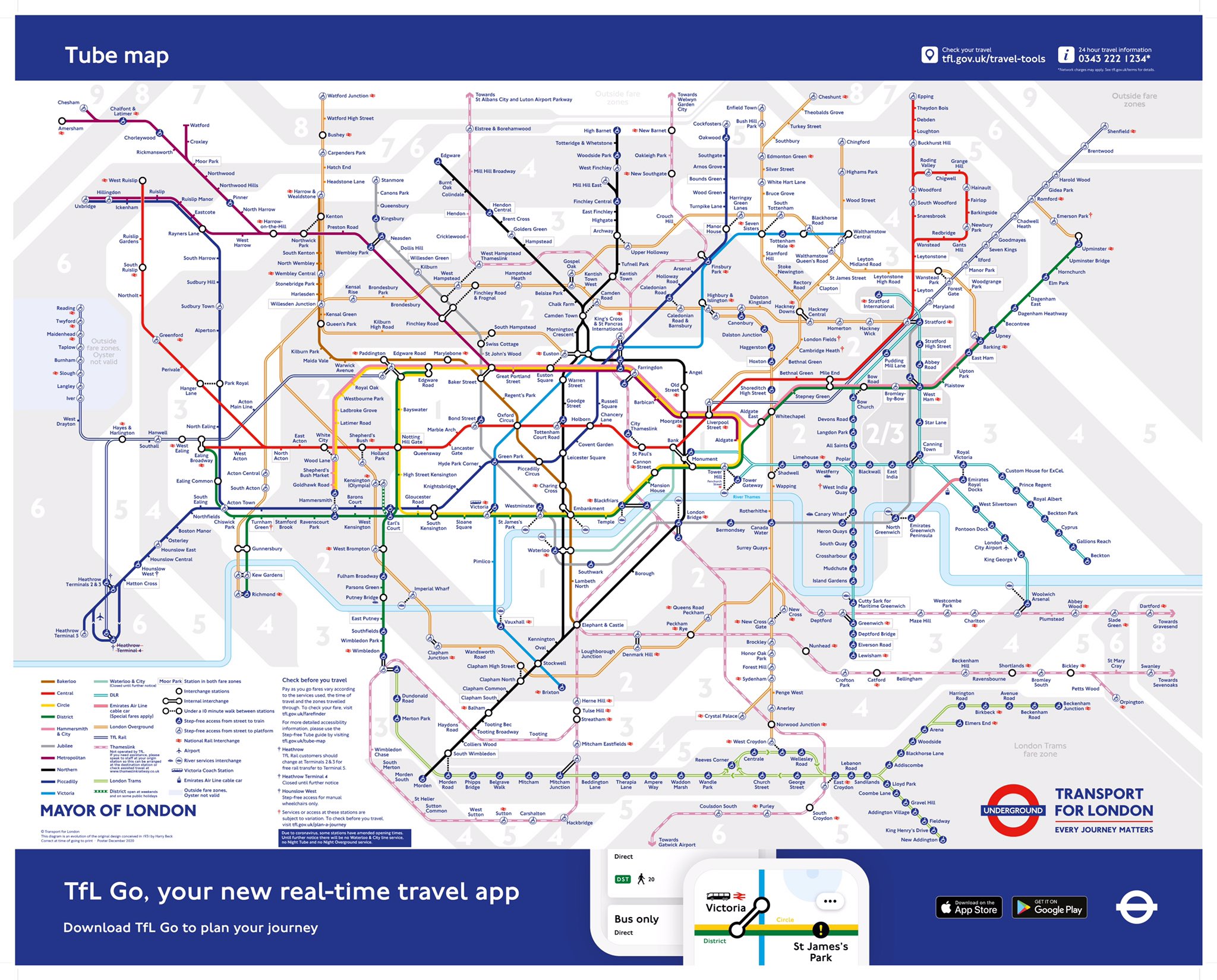
The route was on the map in the 1990s before it was comprehensively upgraded in the past decade.
Thameslink routes, along with national rail, has been on the London Connections map but not TfL’s map.
The move is said to be temporary, which seems odd.
TfL do not operate Thameslink which is under DfT control. The DfT this week indicated a long planned route on Thameslink to Maidstone East may now never go ahead.
Running a site alone takes time and a fair bit of money. Adverts are far from enough to cover it and my living costs as a private renter.
You can support me including via Paypal here Another option is via Patreon by clicking here You can also buy me a beer/coffee at Ko-fi here There's also a Facebook page for the site here Many thanks


Would be nice if this meant the scrapping of the charge to change between overground and underground services within the same journey
It’s a bit pointless having just a ‘tube’ map these days, isn’t it? The London Connections map, showing tube, overground, national rail and tram routes, etc, is superior in every way.