Latest look at cycle lane progress in Woolwich and Charlton
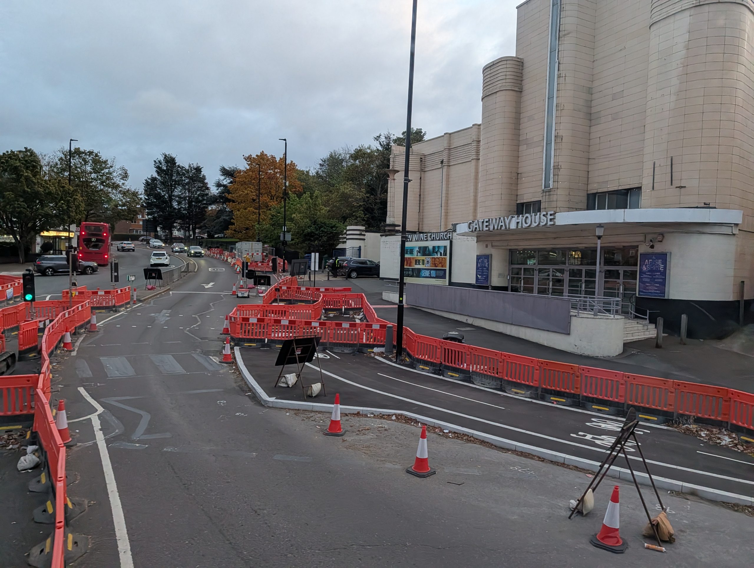
With ever more stretches of a new cycle lane between Woolwich and Charlton looking complete let’s have another look at how it’s shaping up.
This is Cycleway 4 and the first stretch of the latest extension is now officially open at the western end in Charlton near the station, where it links to an existing segregated route through east Greenwich.
Heading east from near Charlton’s Stone Lake Retail park is where we’ll start this update on Woolwich Road. I jumped off a bus here to take photos of a new development that had started to rise and was covered earlier this week.
Alongside its neighbour they’ll total 250 flats.

As seen this is all-but complete. No road space is lost with two lanes remaining in each direction as before.
The cycle lane of course is to provide a travel option for the many thousands of new residents alongside existing locals.

The width of these streets ensure road capacity remains similar to how it was before even with the addition of dedicated cycle lanes.
Heading in the Woolwich-bound direction work is coming along at a roundabout near new housing where the bi-directional lane remains south of the road.

Work is less advanced further east near the site of estate redevelopment that will see nearly 1,000 new homes.
If you’re wondering why the bus stop is so busy in the image below, that’s because TfL cut the 472 through here and replaced it with Superloop SL11. A route which manages to avoid almost every new development and thousands of new homes along its length, though stops at quiet areas near low-rise, low density areas.

That often ensures buses on remaining routes which do stop are jam packed and slower given the need to pick-up more passengers. The familiar “please move upstairs” is often heard.
If TfL want to know why bus passenger numbers are falling this is a great example. Introduce a welcome faster route in the SL11 but then have it avoid many major new catchment areas, entirely cut the busy 472 which did stop then leave other buses to pick up the pieces, in turn slowing them down.
Woolwich
Anyway, back to the cycleway and now we’re firmly in Woolwich and see the least advanced section, with cones and utility works but no outline of a cycle lane yet seen near the listed dockyard chimney.

To the east of here are Woolwich Dockyard estates where Greenwich are considering redeveloping blocks which could see a net increase of 1,000 homes.
It’s in the draft Local Plan but not guaranteed to progress. Nearing Woolwich town centre is the only stretch where road capacity is lost, with buses having to share a single lane with other traffic in the westbound direction.

The cycle lane here is looking complete. It looks wide enough for four lanes which would ensure a bus lane in each direction, but it wasn’t on TfL’s plan.
Finally we reach the Woolwich ferry roundabout where work continues but looks finished in a fair few places, and in others it’s not far off.

This is the extremity of work currently underway on Cycleway 4.
It does extend slightly onto Woolwich High Street where many new homes have been built – and where more will rise at the former Waterfront leisure centre.

TfL plan a convoluted, slower route for future cycle lanes around the town centre’s shopping streets to connect with existing lanes to Plumstead, rather than head via Woolwich High Street and the northern end of Beresford Street.
They do propose a bus lane in the area seen below and Woolwich High Street though given bus stands will remain it all seems a bit pointless as buses will still get stuck in traffic, and cyclists will have to meander around buses.

Then there’s the chronic bad parking and non-existent parking controls which are seemingly never enforced.
To board a bus means can mean running into the road as cars block buses pulling in on stops at Woolwich High Street. Little chance for the elderly, disabled or parents to manage it at times.
Completion
The stretch between Charlton station and the Woolwich ferry is set to be fully complete in late 2027.

After that work moves to fill in the gap through Greenwich town centre alongside works in Woolwich town centre.
Given how far along many parts now seem it’s quite possible most of the route will be usable long before autumn 2027.


