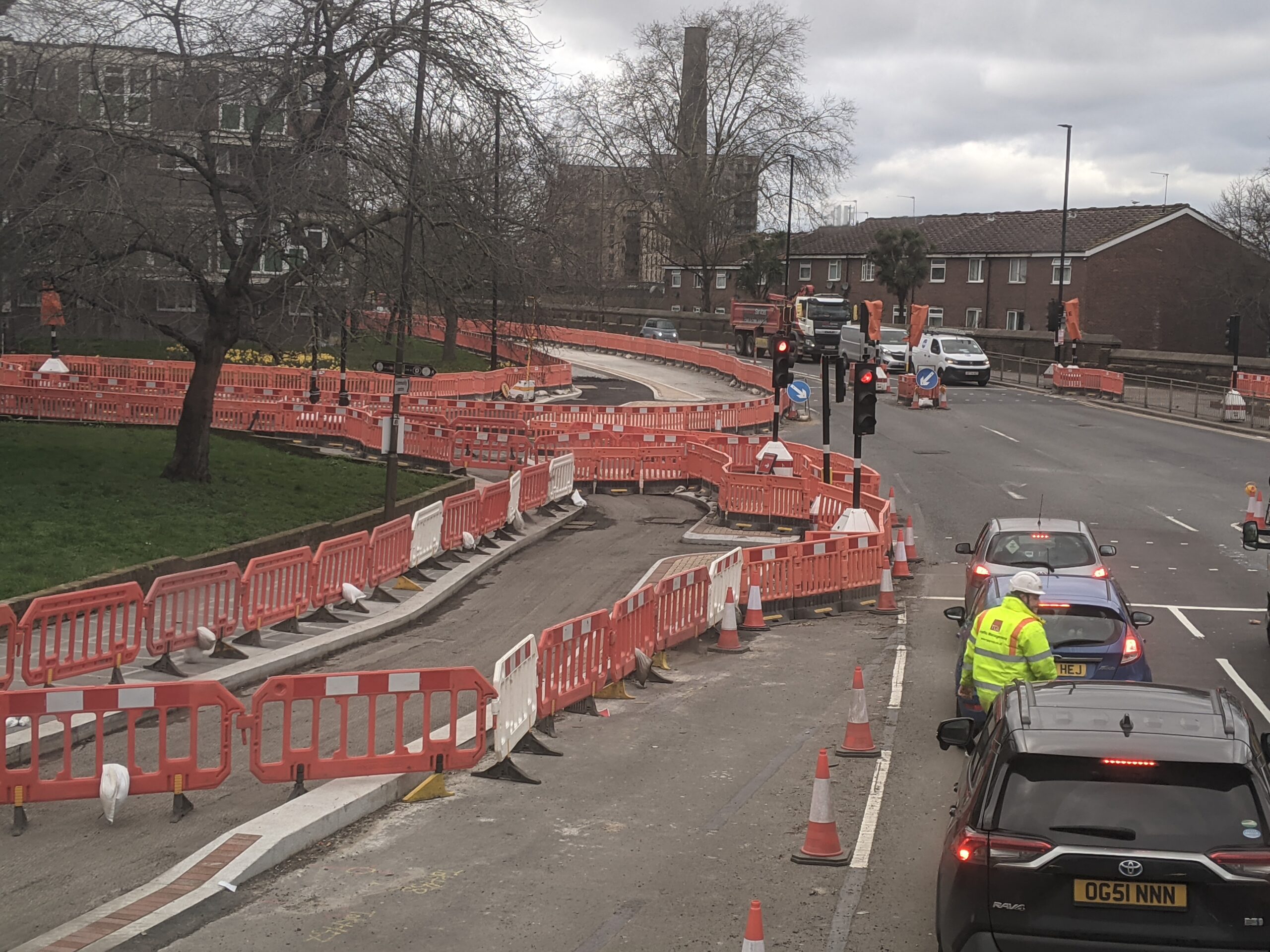
A look at Woolwich to Charlton cycle lane construction work
With each passing week the new cycleway between Woolwich and Charlton is becoming more evident and today’s post will have a look at how it’s shaping up along the route.
Upon completion in 2027 the route will link with the existing Cycleway 4 running from Tower Bridge to Charlton.

Work is mostly progressing at either end with less action in the middle so let’s start at the Woolwich end near the ferry.
The roundabout is reducing in size to accommodate the new cycle lanes.

See below for how it should appear when complete. Road space appears to be the same as now with no loss of lanes.
Cycle lanes from Charlton are located on the southern side of the road so as not to conflict with traffic approaching the Woolwich ferry. To reach the ferry or riverside path requires going all the way around.

Sadly the scheme doesn’t continue east onto the dismal and grim Woolwich High Street past the old Waterfront.
TfL expect cyclists in future to ride through busy areas of Powis Street and then past Lidl to reach cycle lanes onto Plumstead. Yeah, I don’t think many will.

They’re doing it on the cheap across the town centre resulting in ugly streets remaining and a less direct route. It’s also one way to put cyclists in conflict with pedestrians.
This is likely as Greenwich Council have failed to allocate sufficient income derived from many new developments in this area to improve public realm. Time and again TfL requested funds for local improvements and time and again Greenwich would instead give token payments.

Heading to Charlton
Heading west from the ferry roundabout is where the first real emergence of cycle lanes appear. See on the left below.

This is near Woolwich Dockyard and the spot Greenwich council may redevelop housing estates bringing 1,000 extra homes according the authority’s draft Local Plan.
It’s an example of why the cycleway is being built. Thousands of homes are rising in the area and many are, or will be, car-free.

However this brings us to a couple of problems. Firstly if cycling to Woolwich then there’s few spots to park a bike, let alone safely. Racks outside the Elizabeth line station are packed.
Second, the road narrows between the ferry and a spot past Kingsman Street with road space reducing westbound from two to one lane upon completion. That could delay buses as a current dedicated bus lane here will be no more.

Above shows a junction further west near Woolwich Dockyard station. Note the materials used match those from the last big road upgrade in the late 1990s in advance of the Millennium Dome opening.
I’m amazed they found someone still doing them after nearly 30 years. I can’t think of any other public upgrade realm in decades that has.
Past this point and we’re approaching the listed chimney of the former Dockyard opposite new homes.

There’s little going on here but shortly after as we reach Charlton work is underway on one of the roundabouts along the route.
Now we’re in Charlton and yet another roundabout is seeing work. That’s close to hundreds more new homes either recently built or set to start. A staggered crossing is set to become straight-across around here near the Royal Greenwich Trust school.

Shops
Passing yet another roundabout beside Stone Lake retail park (where plans for a drive-through Starbucks have just been submitted) and now we’re almost at the limit of construction near Charlton station.
Not a great deal is evident here. The below image is looking towards the old Antigallican pub. Charlton ststaion is off to the right.

Here’s how the junction will eventually look according to TfL documents.

Previously staggered crossings are to be more direct. The two way cycle lane will also switch from north of the road to the south at this point.
Head past here it meets the current route to Greenwich, Deptford, Rotherhithe, Bermondsey then reaching central London.

The biggest problem (well, perhaps not the biggest but up there) is just how grotty and unwelcoming the cycle lane beneath Angerstein flyover is. An absolutely grim area this still avoids any sort of sustantial improvements. Better lighting, painting, improved street furniture could go a long way here. But no effort whatsoever is made.
Greenery en route
Various areas of greenery are mentioned for the area between Woolwich and Charlton. Whether they last any longer than areas in the east remains to be seen.
Around half a mile’s worth of new planting was installed between Plumstead and Woolwich around 15 years ago (perhaps slightly less,as M&S Foodhall in Woolwich was open) before being removed.

In both areas it was never maintained, became strewn with litter and little else but weeds suvived in places.
In no time it was an eyesore and then concreted over.

We’re currently at the litter strewn and weed stage at recent public realm projects in Abbey Wood and Plumstead High Street.
Greenwich council have sold off the Plumstead car park so will no doubt blame the new owner for it, though most of the landscaping locally isn’t being maintained too well.
It also begs the quesiton of why scarce funds to improve the town were spent on a car park just to sell it shortly after.
And in addition it doesn’t say much about who they sold it too if they’re already letting it become a blot on the High Street after millions spent.
Management
While TfL are taking the lead on the project the Cycleway streets are borough managed and maintained. They’re not in the Tfl route network. But alas, hopefully lessons are learned and when complete the new cycle lane between Woolwich and Charlton brings us usable, attractive and well maintained public space.

Much of the route was horribly outdated design and pretty grim on foot, so that should be one area things are improved, with one of the clearest examples being the link between Charlton station and neabry shops.
As work progresses further updates will be added to this site.
Join the mailing list here to receive updates in your mailbox.
Support this website via Paypal here There's also the Ko-fi option to buy me a coffee Many thanks You can also support the site by adding the Murky Depths as a trusted source in Google here There's also a Facebook page for the site here


Greenwich Council properly maintaining cycling infrastructure? You’re having a laugh…