Woolwich to Charlton cycle lane plan agreed with bus lane cut
Greenwich Council have agreed to various street changes between Charlton and the Woolwich Ferry roundabout as part of an extension to Transport for London’s Cycleway 4.
A number of documents have been uploaded to the council’s website this week with detailed plans and drawings for the route which confirm that part of the westbound bus lane in Woolwich is to be removed.

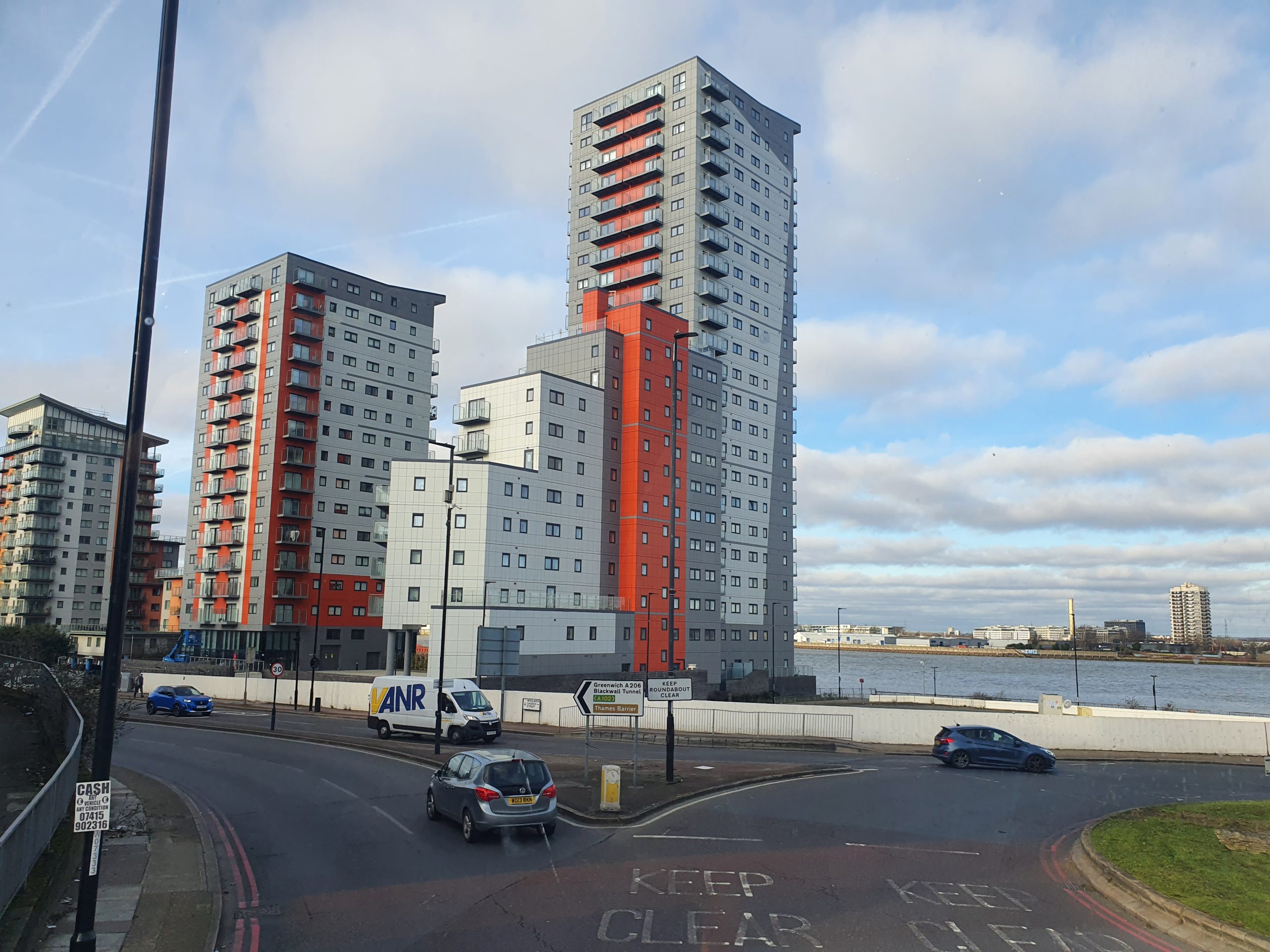
Bus and general traffic will have to share a single lane along Woolwich Church Street near the ferry and Mast Quay development as well as near the rebuilt Morris Walk estate.
The ferry roundabout will also see some substantial changes. A report drawn up by Greenwich Council shows how various groups will be impacted:
Pedestrians
- Changes will see the conversion of five staggered crossings to direct crossings.
- An additional pedestrian crossing on the eastern arm of the Anchor and Hope Lane junction. This will provide a more direct route to the shopping area to the northeast and relieve footway pressure on matchdays at the nearby Charlton Athletic stadium.
- Pedestrian wait times will be reduced on 2 of the 3 arms of the junction where existing crossing facilities are provided. A slight increase in wait times on the southern arm of the junction will be offset by the conversion of the crossing from staggered to direct, meaning people walking will not have to wait on a central reserve while crossing the southern arm.
- A new crossing at Mast Quay will provide safe access to bus stops on either side of the A206.
- A new crossing on the east side of Stonelake Roundabout will improve access to the retail park and bus stops, to be linked with the crossing to west to reduce impact on the roundabout.
- At Woolwich Ferry Roundabout two zebra crossings will be converted to signalised crossings which will reduce interactions with vehicles for people walking.
- Footway widening is proposed at selected locations to improve the area for people walking.
Cycling
- Segregated cycle facilities where there are currently minimal protections, with added low level signals.
- At the Anchor and Hope junction a segregated cross over is designed to safely lead cyclists from the north side of the A206 to the southern side where there are fewer side-road interactions and bypass multiple roundabouts.
- Several pedestrian crossings are to be converted to either toucans or parallel crossings to provide access to/from the cycle tracks.
Buses
Greenwich Council state that the “impacts to buses are expected to remain neutral or a slight improvement to the 2019 layouts overall through this section of the A206” yet the amount of bus lane will reduce from current levels.
- Providing segregated cycle facilities will remove most existing cyclists from the bus lanes, leading to potential reductions in bus delays.
- Degree of Saturation (DoS) at all junctions is expected to be below 90% indicating spare capacity, however some existing merging issues at start of bus lanes may remain.
- Bus lanes are introduced or expanded to mitigate against any traffic queues on approaches to signals.
- It is worth noting that some small sections of bus lane that were introduced under 2020 Covid measures and maintained under the existing experimental traffic order will be reduced. This means overall bus lanes will be increased from before the scheme, but slightly reduced from the current layout.
One issue that stands out when viewing drawings is the removal of a westbound bus lane on Woolwich Church Street which puts buses at greater risk of queues.
That also doesn’t help the planned change of the 472 route which TfL want to replace with Superloop route SL11.

Not only will that change see many places on the route, including thousands of new residents set to move to seven major developments, lose substantial numbers of buses per hour but the new “express” route may be no quicker than the 472 if meeting heavier traffic along the way.
General traffic
In terms of other vehicles the council’s report states that “general traffic is expected to see minimal impact in Section 2 compared to the existing on-street operation” with these changes listed:
- Anchor and Hope junction will see improvements to the westbound ahead lanes and minor increases in saturation values on other lanes, however these all remain under 90% DoS. This is due to the reduction in overall cycle times at the junction which will lead to shorter average wait times for any vehicles arriving on red signals.
- The junction with Frances Street has not been modelled as there are no changes to intergreens or stage order, with the cycle phases being included within the existing pedestrian stage and timings.
- The eastbound entry to Woolwich Ferry Roundabout is being modified from two existing lanes to one full lane, one flare, and a segregated slip directly into the ferry approach. The new slip will provide additional storage capacity while the ferry is loading, reducing impact on the roundabout operation at those times.
- A restriction on motor traffic is proposed at the level crossing on Charlton Lane which would prohibit southbound traffic across the level crossing. The restriction is proposed in response to data showing a high number of vehicles turning left onto Charlton Lane from the A206, which would present a potential safety issue following the introduction of the cycle lane. The restriction is proposed at the level crossing to maintain access to and from residential properties to the north of the crossing.
- It is proposed to ban the right turns into Kingsman Street from the A206 and from Kingsman Street into the A206, following the introduction of a central reserve. This is to restrict the number of movements into and out of this side road location in response to safety concerns following the introduction of the cycle lane. Banning turns in this location would require a small diversion to the signalised Frances Street junction.
Current lanes
To the west segregated lanes exist (mostly) from Charlton to Greenwich with a route through the town centre recently announced filling in an existing gap.
Heading west from Greenwich there’s now a dedicated lane all the way to central London via Deptford, Rotherhithe and Bermondsey.

Other plans are currently in motion to enable a cycle lane through Woolwich town centre to Plumstead.
A drawing within plans on the council’s website this week shows cyclists expected to head around the roundabout and then go the indirect way via Powis Street instead of the obvious route along Woolwich High Street.

It appears this subsequent stretch is being planned on the cheap by directing cyclists on a convoluted route through narrow spaces along Powis Street in areas of high footfall rather than improving some pretty awful streets in Woolwich town centre such as the dual carriageway outside Waterfront.
That’s despite ample new development in the area and resultant Section 106 and Community Infrastructure Levy revenue.

Lack of communication?
The proposed route then appears to link up poorly with streets near the Elizabeth line without much consideration of current public realm changes at General Gordon Square. Well, the consultation didn’t.
It gave all the appearance of minimal communication between those in charge at two major projects running side by side.

For example landscaping is being installed beside the Royal Arsenal Gatehouse which narrows available footspace while a new cycle lane is supposed to somehow also be wedged in.
The same goes for nearby busy bus stops. Note that renders and images released by TfL didn’t show proposed landscaping and reduced footway around the gatehouse and bus stops.

Below shows an image of landscaping taken from Greenwich Council’s plan as part of the Future High Streets project.
This is beside an area of high footfall with a bus stop beside.

Future housing
That footfall will only increase with numerous developments and thousands of homes coming in the immediate vicinity.
Across the street 299 student rooms are now underway. Another student block has been approved next door while shortly north a few metres away 660 homes at Ropeyards are coming.
Immediately beside the extensive landscaping and reduced paving space a building containing Poundstretcher has just been sold for new development while MacBean Street next door will also see high density development.

A short distance away Riverside House will become a hotel and student housing.
To put it bluntly, that’s a lot of extra people traversing the area. Removing footway space may not be wise.
Then TfL putting in cycle lanes in such a space may well cause some problems for various users. One to watch.
Work on the Charlton to Woolwich Ferry section is expected to start later this year. You can view plans for the entire route by clicking here.


I have raised the reduced pedestrian space in Powis Street with TfL and Greenwich Council several times.
They seem to think there won’t be any problems.
Taking in to account the changes to crossings and cycle lanes I do believe they will improve safety for pedestrians and cyclists
Removal of part of the bus lane will definitely slow buses down as they will sit in more traffic on a very busy road.
Route 472 should remain as it is at present.
The new ecpress superloop route SL11 seems rather pointless now. However if stl introduced by TFL should be in addition to the existing 472 and not replace the 472.
It would have made more sense to extend route SL11 though the Silvertown Tunnel to link with bus routes east of the river including Superloop route SL2 North Woolwich to Walthamstow to provide a more joint up Superloop bus network..
That makes perfect sense C.
The road is meant to relieve the pressure on the a2 between Dartford and Blackwall tunnel . Taking lanes away will increase congestion all around the area . The current space is wide enough to facilitate 2 lanes in both directions . Another awful waste of time money that will impact the economy and peoples lifes for worse .