Silvertown tunnel’s approach road network takes shape
After recent completion of construction work for tunnels between Greenwich and Silvertown it’s now the turn of approach roads and junctions north of the Thames to commence.
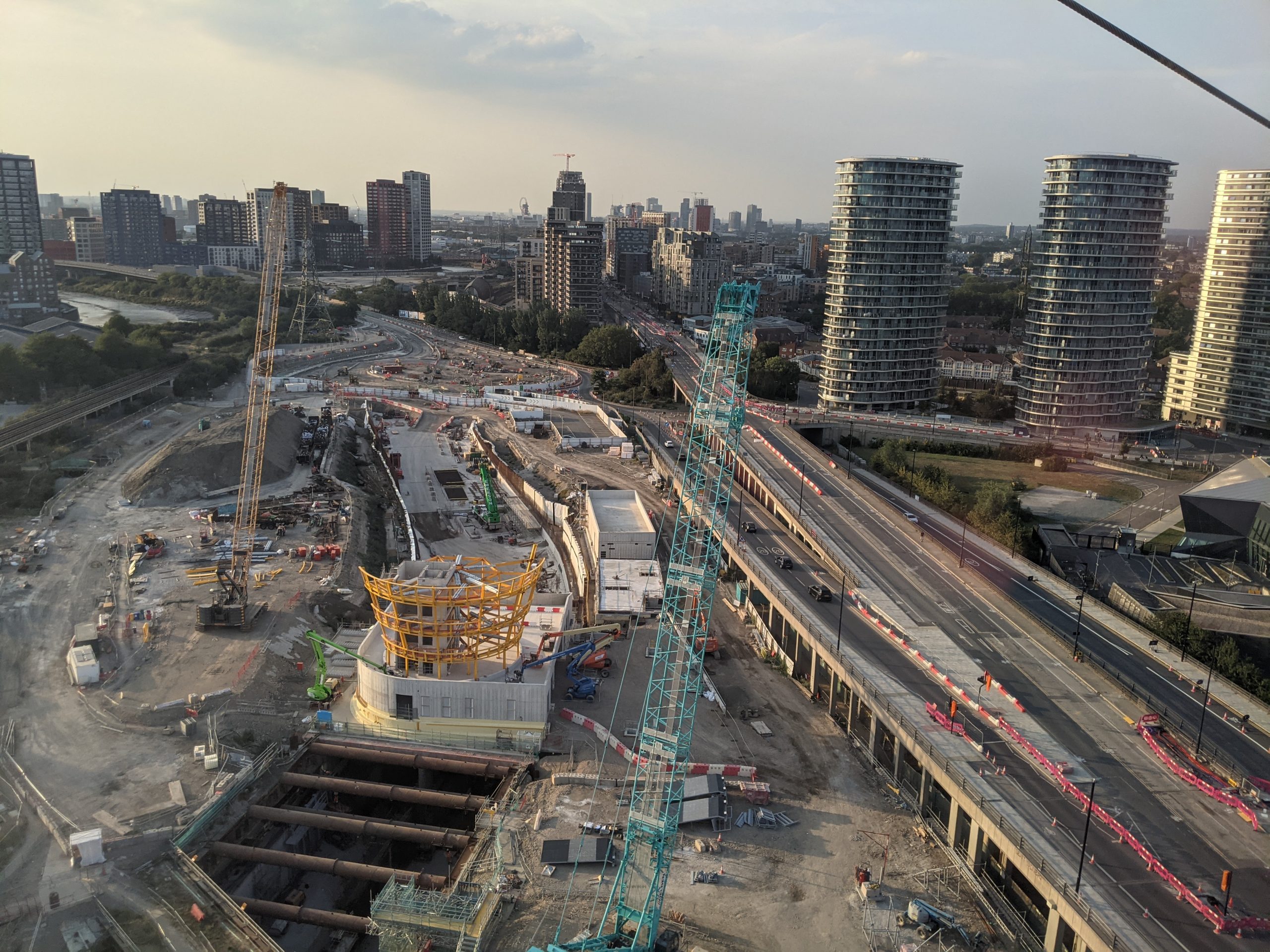
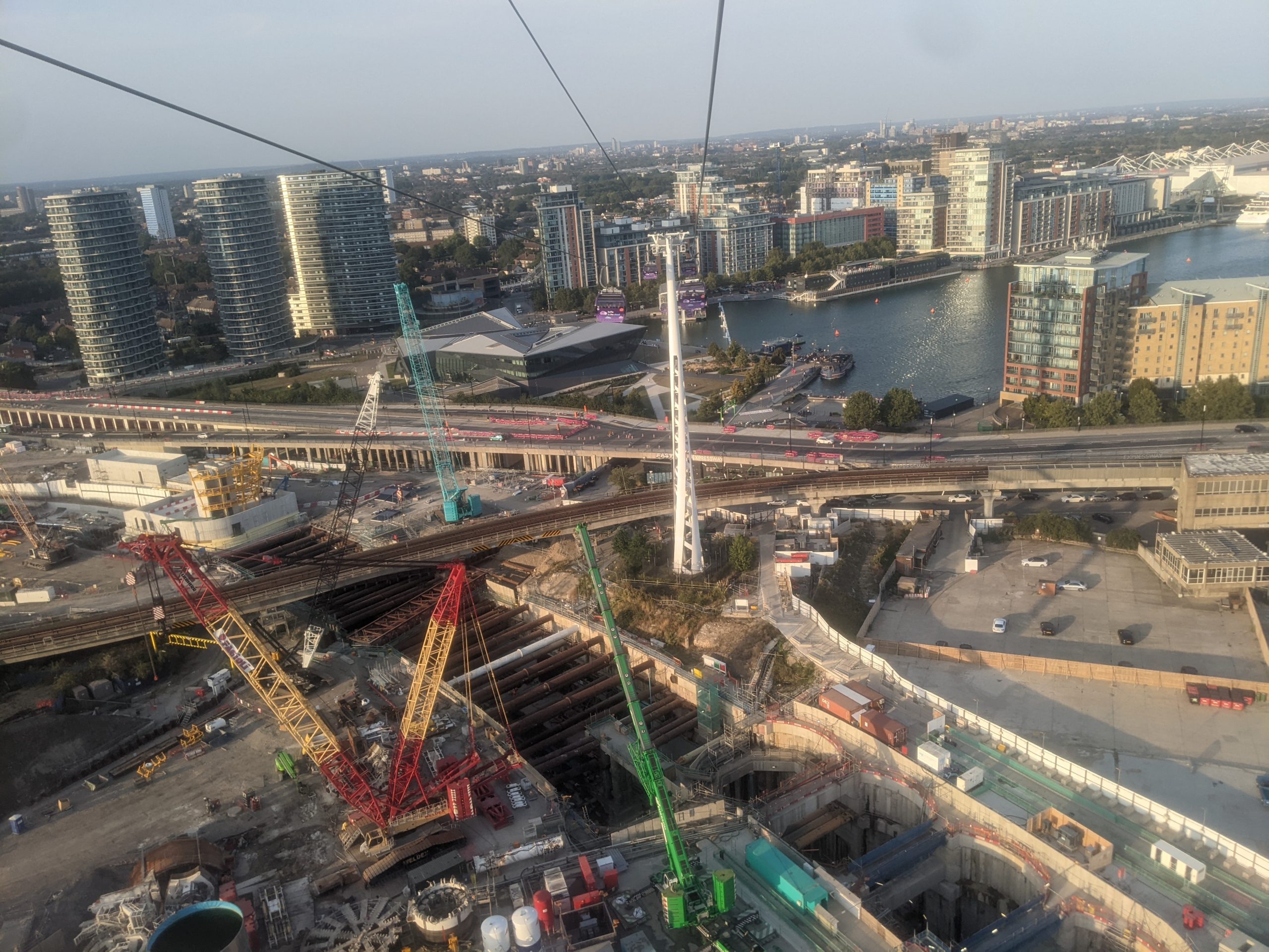
A cable car trip in recent days shows the outline of a forthcoming expanded roundabout and approach roads taking shape.
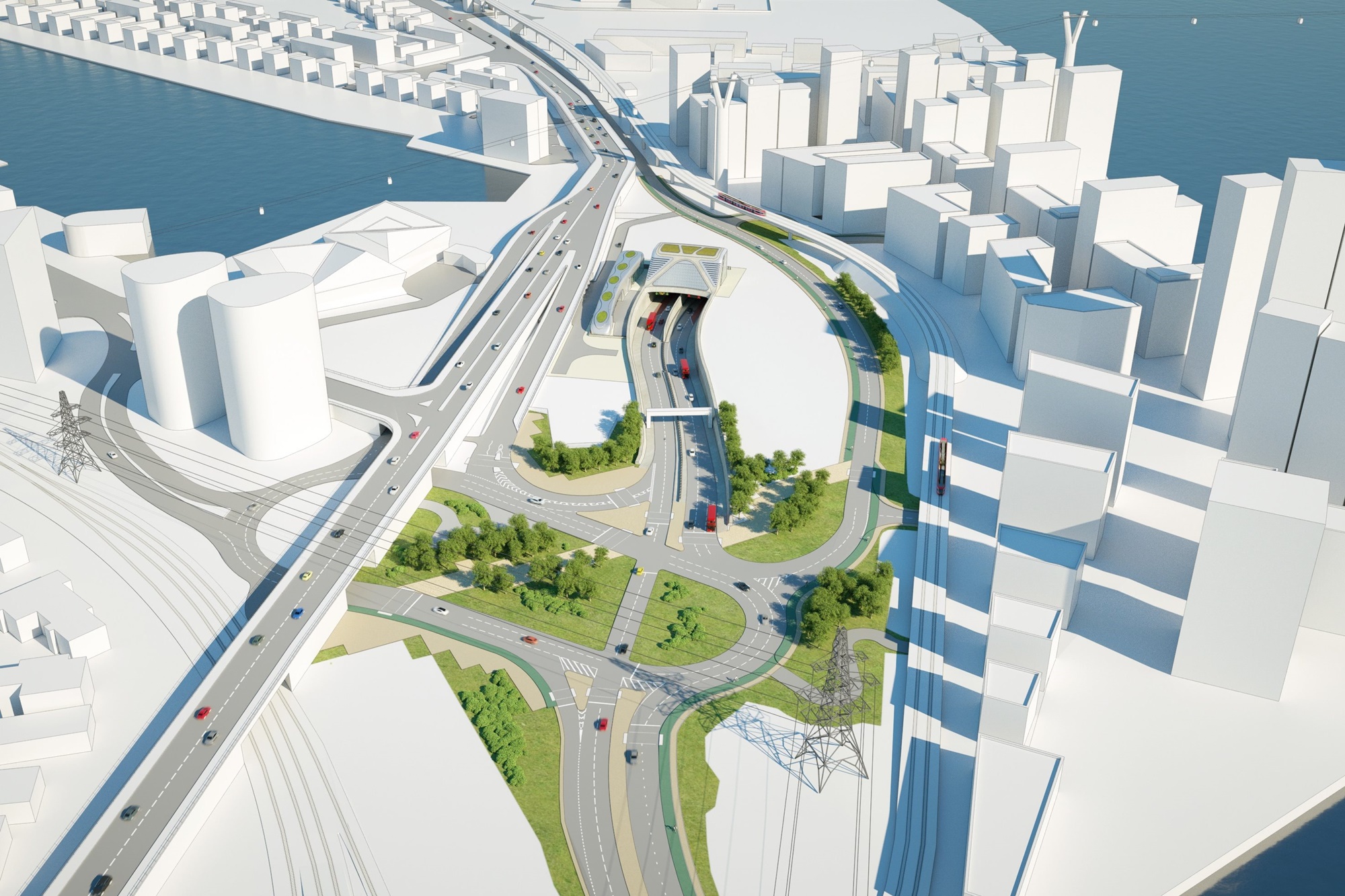
This render shows what is now under construction –
Zooming in these images shows the faint outline of roads which will connect to the Lower Lea Crossing heading towards Canary Wharf and Silvertown Way.
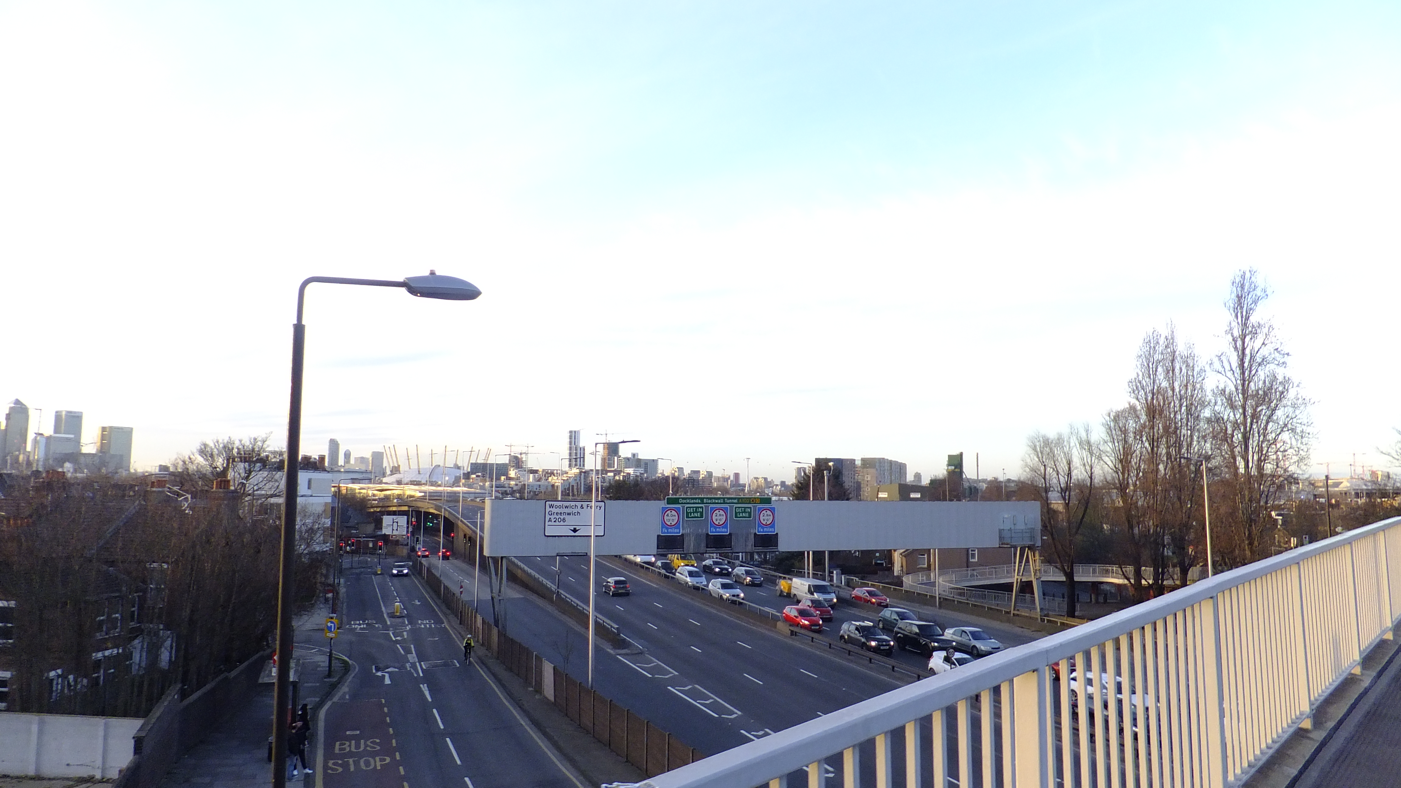
This forthcoming road network takes substantial amounts of land through the reworking of Tidal Basin roundabout.
Traffic is then directed to areas which have recently seen major residential develop or have projects in planning.
Two bus routes will head in separate directions upon departing the northbound tunnel with the X239 heading west and the 129 extended and heading east.
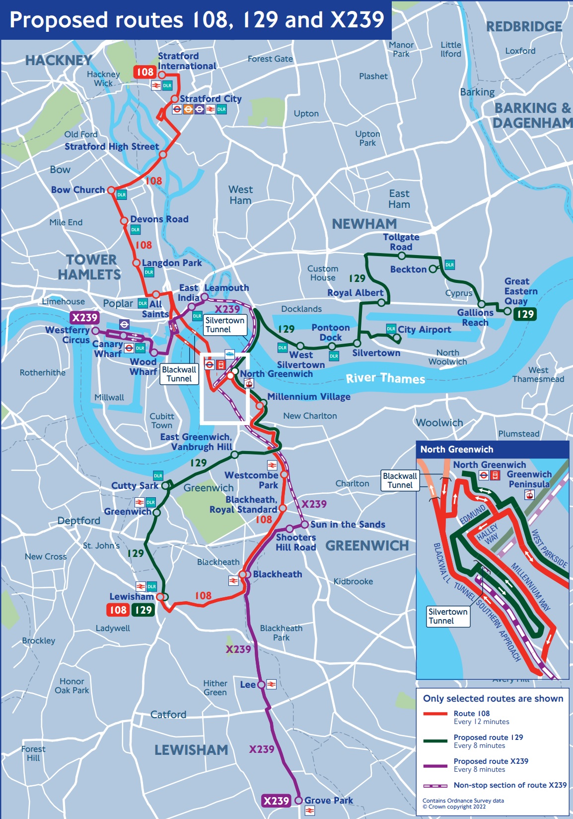
Bus lanes are due to stop almost as soon as the tunnel ends with buses then left to jockey for position among general traffic.
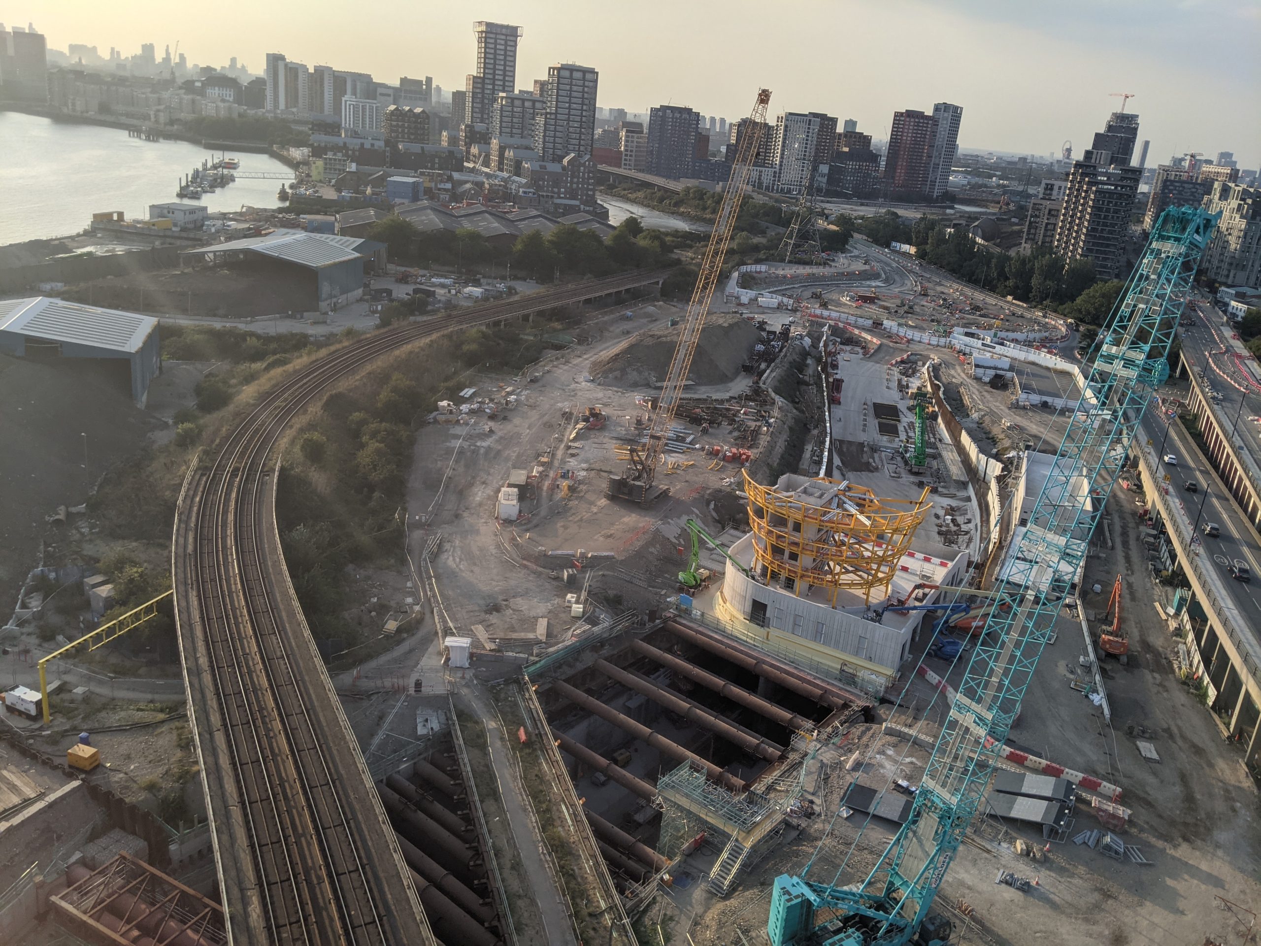
Also visible from 1above ground is a structure rising above the northern portal which has become ever more evident over recent days and weeks. This will act as a control tower.
Note the yellow steel as the circular frame takes shape –
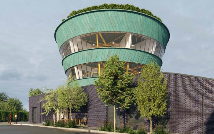
Here’s the expected final appearance according to TfL –
The tunnel is still expected to open in 2025 when both the existing Blackwall Tunnel and the new link will see tolls applied.
Running a site alone takes time and a fair bit of money. Adverts are far from enough to cover it and my living costs as a private renter.
You can support me including via Paypal here Another option is via Patreon by clicking here You can also buy me a beer/coffee at Ko-fi here There's also a Facebook page for the site here Many thanks

Interesting update. Looking at the render of the site that you’ve labelled ‘Roads around northern portal’ and comparing with Google maps, it seems that the project also envisages building lots of high rise residences just South of the DLR line where Scarab Close currently is (on the right in your render). https://www.google.co.uk/maps/@51.5079175,0.0140325,1079a,35y,180h/data=!3m1!1e3?entry=ttu – something I hadn’t been aware of, but probably not a bad thing.
I’m a bit surprised the 108 bus route will continue to use the Blackwall tunnel, since that won’t have bus lanes so is likely to still see buses caught in traffic, and diverting it to the Silvertown Tunnel seems quite easy to do.