Hidden river below south east London to see investment to stop flooding
Money has been allocated to Greenwich Council for flood prevention work along a little known and partly hidden river in south east London.
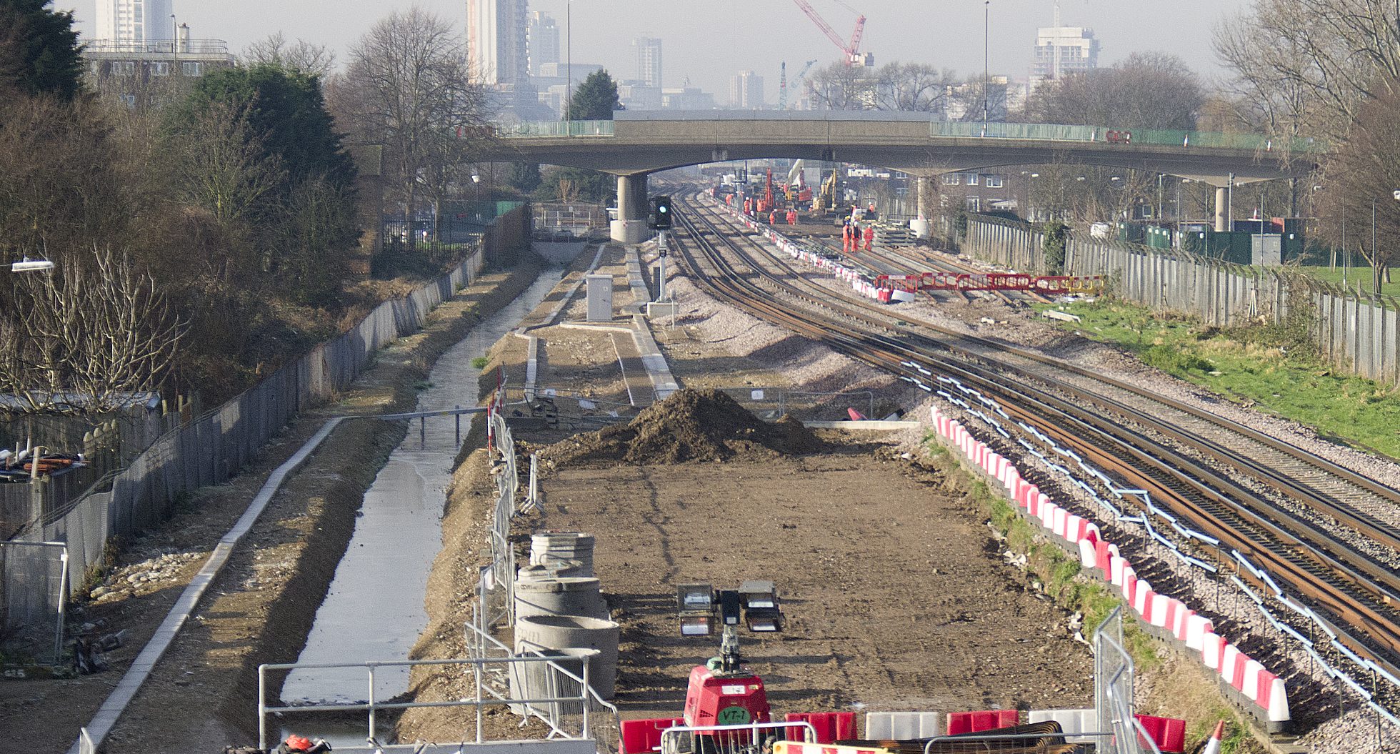
The Wogebourne river – or Wickham Valley Waterway – was covered on this site many years ago when a short stretch was revealed by Crossrail work.
Back in 2015 contractors had to move 270 metres of the rivers course via culverts owing to tracks doubling from two to four before it was covered over once more.
The river stretches from Oxleas Wood heading past Shooters Hill and Plumstead with a Greenwich Council report, somewhat tucked away on the site and uploaded in recent days, including a handy little map.

The official name for the project is “Thamesmead and Marsh Dykes Flood alleviation scheme” .
It continues that “proposals being made for NFM within Oxleas Woods, Clothworkers Woods and Bostall Woods. The aim of the scheme is to use natural flood management to store water in the woody catchments upstream of Thamesmead and in Oxleas, Clothworkers and Bostall Woods/Wickham Valley to protect downstream properties.”
Changing course
A report dating back to 2011 highlights the river’s route which shows a bit more of its path towards the Thames as it heads from Plumstead to Abbey Wood and then alongside the railway before turning north towards the lakes and canals of Thamesmead and then the Thames.

Thamesmead was formerly extensive marshland and of course Ministry of Defence land before the town was created in the 1960s, with many canals and lakes established.
See one such canal can be seen below with a clocktower which once resided in Deptford.

In order to protect against flooding across the area work will create a “catchment based approach to reducing flood risk at varying gradients and multiple locations using a network of leaky dams, earth bunds and flood storage”.
The report notes that a 2016 investigation found “there is significant flood risk from surface water and rivers in the catchment” with a number of homes at risk from flooding.
Homes at risk
Work is designed to protect 9 residential properties at risk in Oxleas Close and Bellegrove Road, directly downstream of Oxleas Woods, in both the 1 in 30 year and the 1 in 100-year event.
In addition directly downstream of Clothworkers Wood, in Dryden Road, Edison Grove and Glenmore Road, 34 properties at risk of flooding.
Within these roads 62 properties are shown to be within Flood Zone 3 from the Wickham Valley watercourse.
Downstream of Bostall Woods, in Streamdale and Woodbrook Road, there are ~60 properties at risk of surface water flooding. Within this area, there are 117 properties in Flood Zone 3.
Parts of the river pass over chalk beds and in the past the wider area along Wickham Lane was also the site of chalk mines used in the construction of bricks.
The reports states “Additional storage of approximately ~400-450m3 will be created within the Wickham Valley open space through the excavation of 2 small wetlands to capture overland flow and let it infiltrate in the chalk bedrock.”
In total £821,667.80 of Grant Funding is available from the Environment Agency and Department for Environment, Food & Rural Affairs (DEFRA).


