Woolwich estate rebuild part two: Morris Walk South
Last week I took a look at plans to rebuild Morris Walk North estate in Woolwich. Today we’ll look at the separate but related Morris Walk South application.
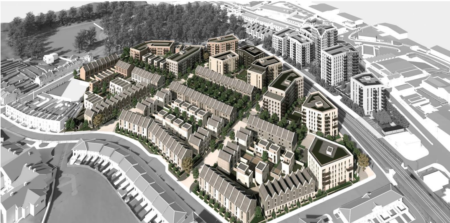
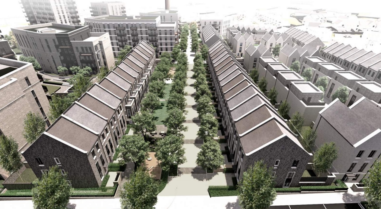
Firstly the design. Taller blocks line the railway (but with no welcoming, accessible way to cross the line – see last week’s post for an in depth look at this) with heights then reducing further south towards terraced housing. Housing numbers rise from 410 in the existing estate to 462. North of the line they double to 304.
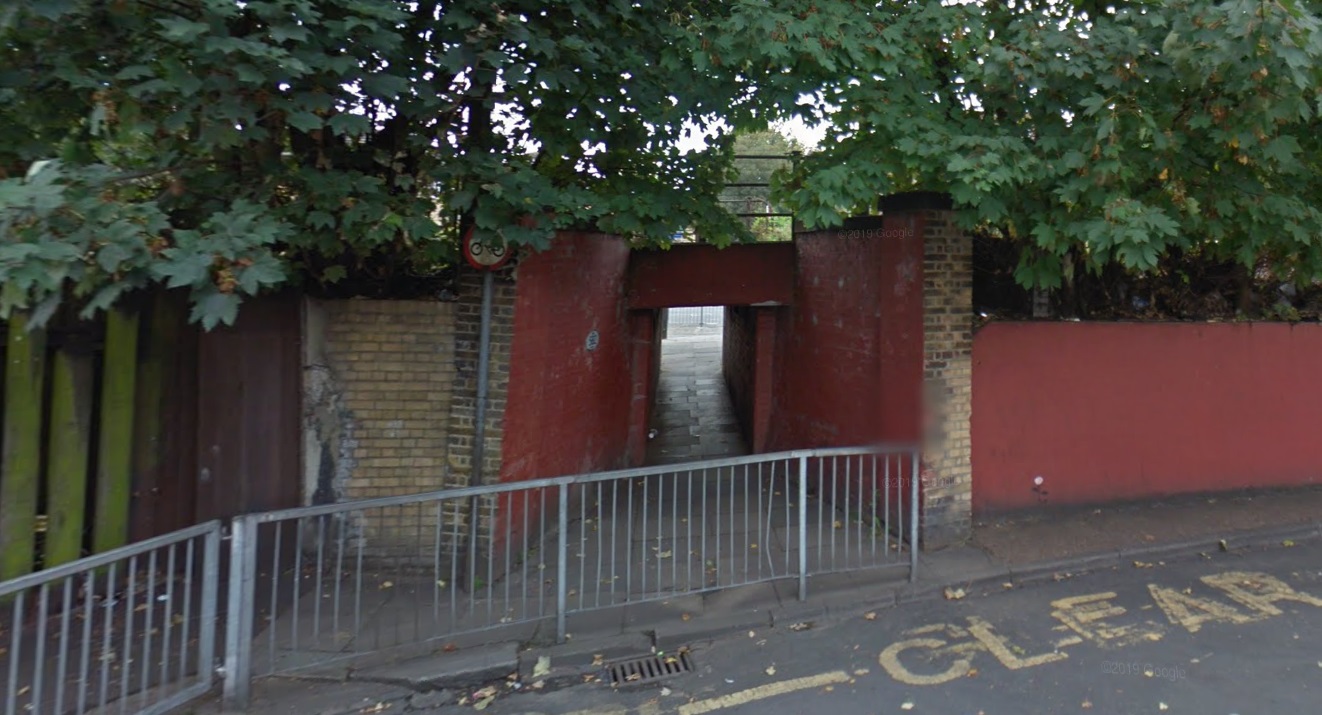
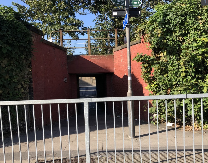
A green strip through the site leads to the only accessible crossing linking Morris Walk North and South; this unwelcoming underpass:
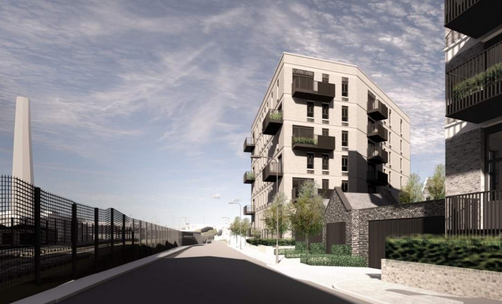
An area beside the underpass at Morris Walk South is named the Arrival Square. The application states: “The Arrival Square is the key arrival space to the scheme from the east, celebrating (not being robbed?) and creating a visual link through the proposed development through to Maryon Park west of the site, and linking with the underpass and access to the Morris North site.”
The application notes problems but offers no solution:
“The railway line cuts through the two sites and is bound by chainlink fencing with climbing plants. The railway and the associated fences block views between Morris North and South. Pedestrian access is funnelled through the tunnel on the east and the Network Rail footbridge to the west (a 1960s bridge tucked away and not accessible via ramps) which means that Morris South has poor access to the bus routes and other facilities north of the railway“.
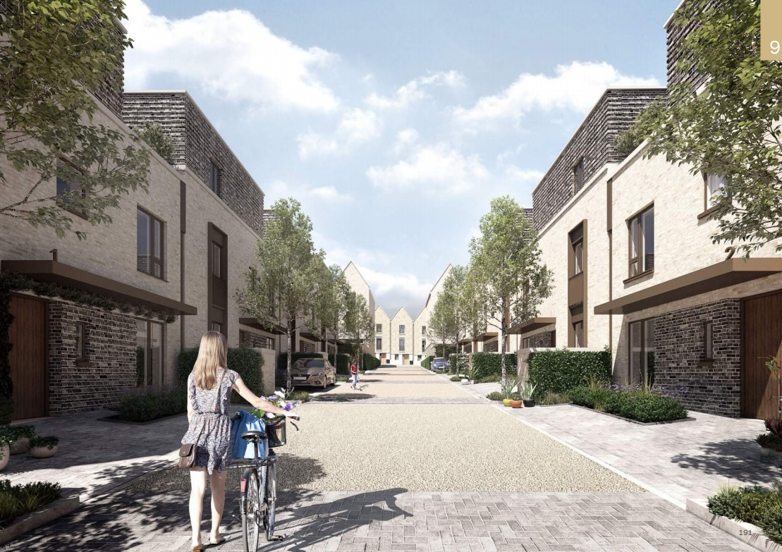
Terraced housing looks decent on plots to the south. A tried and tested style slightly contemporised. I can see this swaying the Planning Board over other issues.
Affordable housing
There is a vast reduction. The proposed development provides just 27 per cent at a site which was formerly around 90 per cent. Of the 27 per cent “affordable”, there are 90 “affordable rented” and 34 intermediate homes. Taking away shared-ownership which is anything but affordable to many when rent and service charges are added onto a mortgage, and “affordable” provision is even worse.
The loss will be borne in ever increasing costs to house homeless people in emergency accommodation as social housing is reduced. Make no mistake, this will cost local taxpayers vast sums and benefit private landlords. The loss of social housing already is in Greenwich borough (and most others too) – and is a key factor in Bexley Council’s current financial problems.
Transport
Like Morris North, this application doesn’t look at pressures on buses and trains. It again states there are plenty of parking spaces in the area to accommodate cars despite pavement parking being prevalent in adjacent streets. Parking is set at 281 spaces for 462 homes. Overspill seems likely. There is no controlled parking zone nor is one planned.
The amount of times I’ve seen this claim in applications – which then translates into parking problems – is extremely high.
The site will also have shared surfaces with no defined paths. A nice idea, but have they ever seen parking in the area?
The current states had an abysmal public realm so the foundations of better placemaking are better, but it’s the detailing that lets it down. The street above will be full of cars with pedestrians – especially those in wheelchairs and using buggies – blocked.
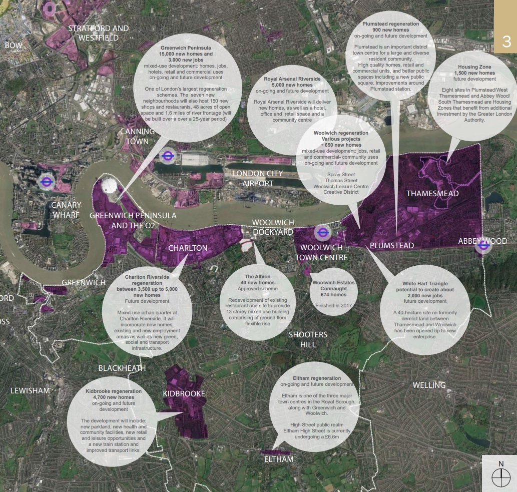
Mistakes
Like the Morris Walk North application, this application has entirely incorrect numbers on other developments within the borough. It’s many thousands out. Click below to enlarge one image seen in the application.
Alongside no mention of impact on buses and rail, the application doesn’t bode well on forecasting pressures on transport. We’ll have to see numbers allocated to TfL when it goes before the Planning Board. As covered earlier today, amounts allocated from a development in Thamesmead were almost a quarter of the total TfL requested. After revision it’s now just over half.

Not sure how this affordable housing offer can stand…London plan states estate regeneration schemes must replace affordable units as ‘like-for-like’
My nan lived in tivoli gardens for years and got mugged under that underpass on the way to the Albion. Maybe you should name parts round the new houses after some old residents. Her name was Elisabeth Ring but was known as Bess would be lovely to have an Elizabeth way or Bess Broadway
The link between the two parts of the development should be above ground. The low-rise terrace properties look nice, but the build quality will be poor.